Latitude: 54.0847 / 54°5'4"N
Longitude: -0.8761 / 0°52'34"W
OS Eastings: 473618
OS Northings: 465999
OS Grid: SE736659
Mapcode National: GBR QPB6.3J
Mapcode Global: WHFBM.JL0H
Plus Code: 9C6X34MF+VH
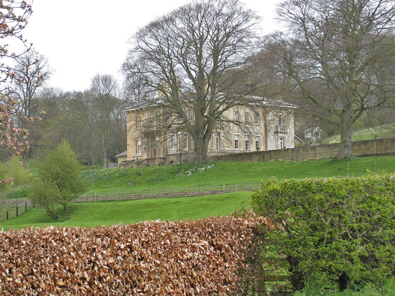
Entry Name: Kirkham Hall
Listing Date: 10 October 1966
Grade: II
Source: Historic England
Source ID: 1149077
English Heritage Legacy ID: 328749
ID on this website: 101149077
Location: Kirkham, North Yorkshire, YO60
County: North Yorkshire
District: Ryedale
Civil Parish: Westow
Traditional County: Yorkshire
Lieutenancy Area (Ceremonial County): North Yorkshire
Tagged with: House
FIRBY KIRKHAM LANE SE 76 NE (north side, off) 1/45 Kirkham Hall 10.10.66 II GV
House. Early C19. Ashlar, Westmorland slate roof. 2 storeys, 5 bays, the outer ones breaking forward slightly. 15-pane unequal sashes with French door to left. Outer bays have architraves with triglyph friezes. First floor: sashes with glazing bars to inner bays. 18-pane sashes with stone balustrades to outer bays. Wide eaves held on paired consoles. Hipped roof. End and ridge stacks.
Listing NGR: SE7362765990
External links are from the relevant listing authority and, where applicable, Wikidata. Wikidata IDs may be related buildings as well as this specific building. If you want to add or update a link, you will need to do so by editing the Wikidata entry.


Other nearby listed buildings