Latitude: 54.0834 / 54°5'0"N
Longitude: -0.8783 / 0°52'41"W
OS Eastings: 473477
OS Northings: 465856
OS Grid: SE734658
Mapcode National: GBR QP96.NZ
Mapcode Global: WHFBM.GMZG
Plus Code: 9C6X34MC+9M
Entry Name: Kirkham Manor Farmhouse
Listing Date: 10 October 1966
Grade: II
Source: Historic England
Source ID: 1149076
English Heritage Legacy ID: 328748
ID on this website: 101149076
Location: Kirkham, North Yorkshire, YO60
County: North Yorkshire
District: Ryedale
Civil Parish: Westow
Traditional County: Yorkshire
Lieutenancy Area (Ceremonial County): North Yorkshire
Tagged with: Farmhouse
FIRBY KIRKHAM LANE SE 76 NW (north side) 1/44 Kirkham Manor Farmhouse 10.10.66 GV II
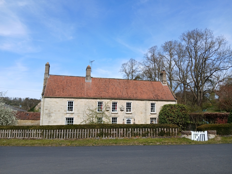
House. Early/mid C18 with C20 renovations. Sandstone rubble fronted with white ashlar, French tile roof. L-shaped plan, the outer bays of front range probably being additional to original 3-bay core. 2 storeys, 5 bays. C20 half-glazed door. Sashes with glazing bars to inner bays. 16-pane sashes to outer bays. First floor: sashes with glazing bars throughout. Keyed stone lintels throughout. 2 carved figures of feasting monks to central bays. Stepped eaves course. Steeply-pitched swept roof. Gable coping, shaped kneelers, rebuilt end and ridge stacks, that to left being external.
Listing NGR: SE7347765856
External links are from the relevant listing authority and, where applicable, Wikidata. Wikidata IDs may be related buildings as well as this specific building. If you want to add or update a link, you will need to do so by editing the Wikidata entry.


Other nearby listed buildings