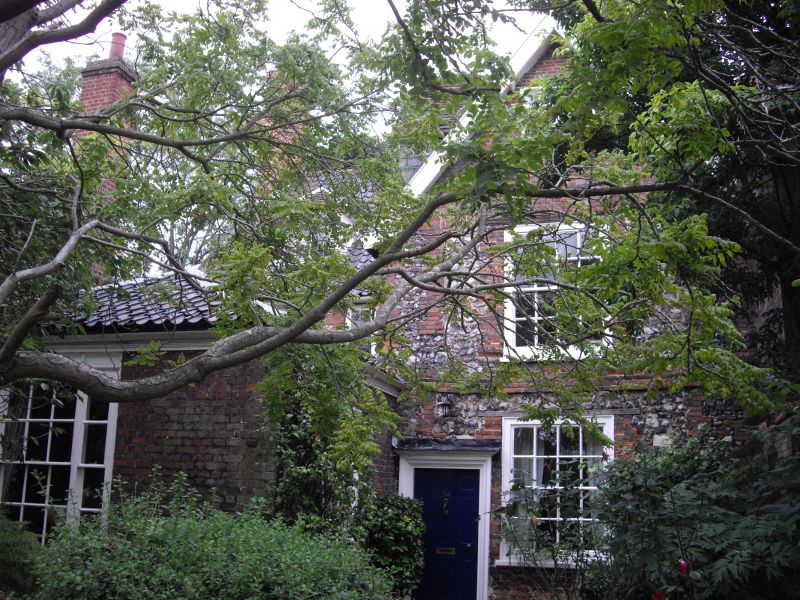
Latitude: 52.6311 / 52°37'51"N
Longitude: 1.3033 / 1°18'11"E
OS Eastings: 623640
OS Northings: 308824
OS Grid: TG236088
Mapcode National: GBR WBJ.F6
Mapcode Global: WHMTM.Z4S9
Plus Code: 9F43J8J3+C8
Entry Name: 34, the Close
Listing Date: 26 February 1954
Grade: II*
Source: Historic England
Source ID: 1372783
English Heritage Legacy ID: 228951
ID on this website: 101372783
Location: The Close, Norwich, Norfolk, NR1
County: Norfolk
District: Norwich
Electoral Ward/Division: Thorpe Hamlet
Parish: Non Civil Parish
Built-Up Area: Norwich
Traditional County: Norfolk
Lieutenancy Area (Ceremonial County): Norfolk
Tagged with: Building
TG 2308 NE THE CLOSE 17/202 26.2.54 No.34 GV II* Formerly part of brewhouse, now house. C17 with C18 alterations, incorporating mediaeval brewhouse. C19 single-storey front extension. Flint with brick dressings. Stone dressings. Pintile roof. Pantile roof on C19 extension. L-shape plan. 2 storeys plus attic. Single gabled-bay projecting and 2 first-floor mullion and transom windows to left. Left-hand off-centre door with moulded surround in projecting bay. Sash window above door with glazing bars and brick reveals in blocked wider opening. 4-light mullion and transom window in gable. One cross-dormer in projecting bay and one hipped-roof dormer with 2-light casement above mullion and transom windows. Single storey extension to the left of projecting bay with sash window with glazing bars and side-lights. Hipped roof. C18 2-storey extension to north of former brewhouse. One bay. Flint ground floor with brick first floor. Mediaeval buttress at junction of C18 and C19 extensions and coinciding stone quoins on rear walls.
Listing NGR: TG2364008824
External links are from the relevant listing authority and, where applicable, Wikidata. Wikidata IDs may be related buildings as well as this specific building. If you want to add or update a link, you will need to do so by editing the Wikidata entry.


Other nearby listed buildings