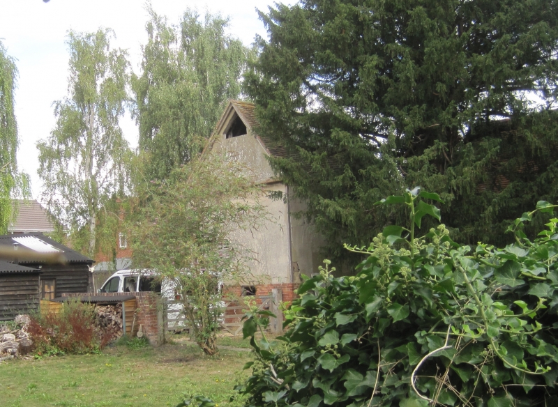
Latitude: 51.6125 / 51°36'45"N
Longitude: -1.4218 / 1°25'18"W
OS Eastings: 440131
OS Northings: 190570
OS Grid: SU401905
Mapcode National: GBR 6XT.TLH
Mapcode Global: VHC0W.9QPP
Plus Code: 9C3WJH7H+27
Entry Name: Dovecote Approximately 1 Metre South West of Brook House
Listing Date: 25 March 1988
Grade: II
Source: Historic England
Source ID: 1368656
English Heritage Legacy ID: 250175
ID on this website: 101368656
Location: Grove, Vale of White Horse, Oxfordshire, OX12
County: Oxfordshire
District: Vale of White Horse
Civil Parish: Grove
Built-Up Area: Wantage
Traditional County: Berkshire
Lieutenancy Area (Ceremonial County): Oxfordshire
Tagged with: Dovecote
GROVE THE GREEN SU4090 (North side) 15/137 Dovecote approx.1m SW of Brook House
GV II
Dovecote. Probably early C18. Brick to ground floor; lined render on timber-framing to first floor; old plain-tile roof. 2-storey, 2-bay range. Plank door to ground floor centre. Interior: wooden dove-boxes to first floor. Queenpost roof.
Listing NGR: SU4013190570
External links are from the relevant listing authority and, where applicable, Wikidata. Wikidata IDs may be related buildings as well as this specific building. If you want to add or update a link, you will need to do so by editing the Wikidata entry.


Other nearby listed buildings