Latitude: 51.6117 / 51°36'42"N
Longitude: -1.4222 / 1°25'20"W
OS Eastings: 440102
OS Northings: 190473
OS Grid: SU401904
Mapcode National: GBR 6XT.TGY
Mapcode Global: VHC0W.9RGC
Plus Code: 9C3WJH6H+M4
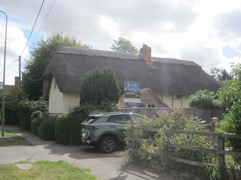
Entry Name: Brookside Cottage
Listing Date: 25 March 1988
Grade: II
Source: Historic England
Source ID: 1048152
English Heritage Legacy ID: 250159
ID on this website: 101048152
Location: Grove, Vale of White Horse, Oxfordshire, OX12
County: Oxfordshire
District: Vale of White Horse
Civil Parish: Grove
Built-Up Area: Wantage
Traditional County: Berkshire
Lieutenancy Area (Ceremonial County): Oxfordshire
Tagged with: Cottage Thatched cottage
GROVE DENCHWORTH ROAD SU4090 (South side) 15/121 Brookside Cottage
GV II
House. Late C17. Stone uncoursed rubble to ground floor right; large timber-framing with painted brick infill; thatch roof, half-hipped to right, hipped with catslide to left; brick ridge stack to centre. Single storey and attic; 4-window range at right-angles to road. Plank door to centre. Irregular fenestration of casements. 2 swept dormers. Interior not inspected.
Listing NGR: SU4010290473
External links are from the relevant listing authority and, where applicable, Wikidata. Wikidata IDs may be related buildings as well as this specific building. If you want to add or update a link, you will need to do so by editing the Wikidata entry.


Other nearby listed buildings