Latitude: 51.6116 / 51°36'41"N
Longitude: -1.4226 / 1°25'21"W
OS Eastings: 440080
OS Northings: 190460
OS Grid: SU400904
Mapcode National: GBR 6XT.TDD
Mapcode Global: VHC0W.9R9G
Plus Code: 9C3WJH6G+JX
Entry Name: Orchard Cottage
Listing Date: 25 October 1951
Last Amended: 25 March 1988
Grade: II
Source: Historic England
Source ID: 1368653
English Heritage Legacy ID: 250160
ID on this website: 101368653
Location: Grove, Vale of White Horse, Oxfordshire, OX12
County: Oxfordshire
District: Vale of White Horse
Civil Parish: Grove
Built-Up Area: Wantage
Traditional County: Berkshire
Lieutenancy Area (Ceremonial County): Oxfordshire
Tagged with: Cottage
GROVE DENCHWORTH ROAD SU4090 (South side) 15/122 Orchard Cottage 25/10/51 (Formerly listed as Orchard Way)
GV II
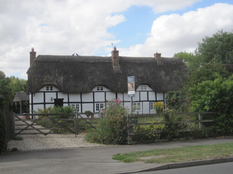
House. Early C18, with C20 addition to left. Rendered plinth; large timber-framing with rendered infill; C20 false timbering to left; thatch half-hipped roof; brick end stack to left, ridge stacks to centre, and to right of centre. Single storey and attic; 4-window range. 6-panel door to left. C20 two-light casements to ground floor. 3 swept dormers to roof. Interior not inspected.
Listing NGR: SU4008090460
External links are from the relevant listing authority and, where applicable, Wikidata. Wikidata IDs may be related buildings as well as this specific building. If you want to add or update a link, you will need to do so by editing the Wikidata entry.


Other nearby listed buildings