Latitude: 52.4553 / 52°27'19"N
Longitude: -1.2002 / 1°12'0"W
OS Eastings: 454447
OS Northings: 284451
OS Grid: SP544844
Mapcode National: GBR 8PP.3DB
Mapcode Global: VHCTD.4KW3
Plus Code: 9C4WFQ4X+4W
Entry Name: Hind Hotel
Listing Date: 14 May 1970
Last Amended: 30 September 1993
Grade: II
Source: Historic England
Source ID: 1292770
English Heritage Legacy ID: 392569
Also known as: The Hind Hotel, Lutterworth
ID on this website: 101292770
Location: Lutterworth, Harborough, Leicestershire, LE17
County: Leicestershire
District: Harborough
Civil Parish: Lutterworth
Built-Up Area: Lutterworth
Traditional County: Leicestershire
Lieutenancy Area (Ceremonial County): Leicestershire
Church of England Parish: Lutterworth St Mary
Church of England Diocese: Leicester
LUTTERWORTH HIGH STREET SP5484 1323-0/9/76 (West side) 14/05/70 No.8 Hind Hotel (Formerly Listed as: HIGH STREET (West side) Hind Inn) GV II
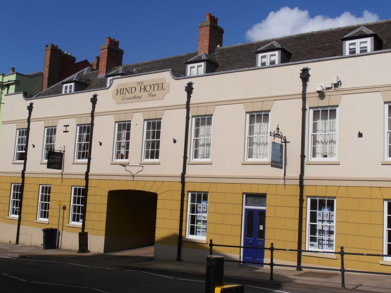
Inn, now hotel. Late C17 or early C18 with mid C19 front. Plastered brick on plinth with moulded platband over ground floor. Coped parapet ramped up at ends and in centre to plain tiled roof with four hipped dormers. Ridge stacks in centre and to ends. Two storeys and attics; slightly irregular fenestration of eight windows on first floor and six on ground floor, all 12-pane hornless sashes except tripartite sash on first floor to extreme left. All windows with raised keyblocks. Wide segment-headed archway to left of centre with doubled panelled doors, leading to coaching yard at rear. Panelled door with transom light over to right of centre. The rear of the street block has gables with inset round windows. Various gabled wings to rear, probably late C17 or early C18 in date. Interior: C18 stair with narrow well, turned balusters and rising string. Inglenook fireplace with panelled cupboard with H-hinges. The later (C19) public house partitions survive.
Listing NGR: SP5444084450
External links are from the relevant listing authority and, where applicable, Wikidata. Wikidata IDs may be related buildings as well as this specific building. If you want to add or update a link, you will need to do so by editing the Wikidata entry.


Other nearby listed buildings