Latitude: 52.4552 / 52°27'18"N
Longitude: -1.1998 / 1°11'59"W
OS Eastings: 454470
OS Northings: 284442
OS Grid: SP544844
Mapcode National: GBR 8PP.3GK
Mapcode Global: VHCTD.5K15
Plus Code: 9C4WFR42+33
Entry Name: Town Hall
Listing Date: 11 January 1955
Grade: II
Source: Historic England
Source ID: 1211129
English Heritage Legacy ID: 392574
ID on this website: 101211129
Location: Lutterworth, Harborough, Leicestershire, LE17
County: Leicestershire
District: Harborough
Civil Parish: Lutterworth
Built-Up Area: Lutterworth
Traditional County: Leicestershire
Lieutenancy Area (Ceremonial County): Leicestershire
Church of England Parish: Lutterworth St Mary
Church of England Diocese: Leicester
Tagged with: City hall Seat of local government
LUTTERWORTH HIGH STREET SP5484 1323-0/9/81 (East side) 11/01/55 Town Hall GV II
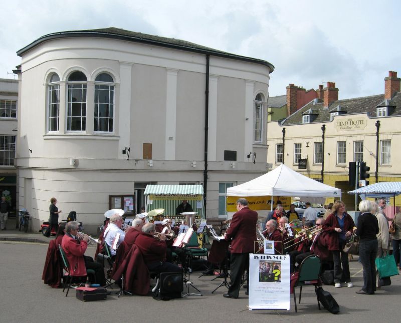
Town Hall. 1836 by John Aloysius Hansom in a Greek revival style. Stuccoed and horizontally-rusticated on ground floor, plain above. Platband over ground floor, and moulded cornice to parapet hiding slate roof. Central projection with first floor blind Ionic portico in antis carrying pediment. Three recessed glazing bar sashes on ground floor, below spaces between columns. Rounded wings with three arched windows, coupled, on first floor with, to right, doubled half-glazed doors below with transom-light over and single glazing bar sash on ground floor to left. Lefthand return front articulated with pilasters and further triple-arched window at lefthand corner, matching that to right. Entrance below. An ingenious ground plan designed to accommodate an awkward site. (The Buildings of England: Pevsner N, Williamson E, Brandwood G: Leicestershire and Rutland: London: 1984-: 301).
Listing NGR: SP5447084442
External links are from the relevant listing authority and, where applicable, Wikidata. Wikidata IDs may be related buildings as well as this specific building. If you want to add or update a link, you will need to do so by editing the Wikidata entry.


Other nearby listed buildings