Latitude: 52.4554 / 52°27'19"N
Longitude: -1.2001 / 1°12'0"W
OS Eastings: 454449
OS Northings: 284463
OS Grid: SP544844
Mapcode National: GBR 8PP.3D9
Mapcode Global: VHCTD.4KW1
Plus Code: 9C4WFQ4X+5W
Entry Name: 4 and 6, High Street
Listing Date: 30 September 1993
Grade: II
Source: Historic England
Source ID: 1211088
English Heritage Legacy ID: 392568
ID on this website: 101211088
Location: Lutterworth, Harborough, Leicestershire, LE17
County: Leicestershire
District: Harborough
Civil Parish: Lutterworth
Built-Up Area: Lutterworth
Traditional County: Leicestershire
Lieutenancy Area (Ceremonial County): Leicestershire
Church of England Parish: Lutterworth St Mary
Church of England Diocese: Leicester
Tagged with: Building
LUTTERWORTH HIGH STREET SP5484 1323-0/9/75 (West side) Nos.4 AND 6 GV II
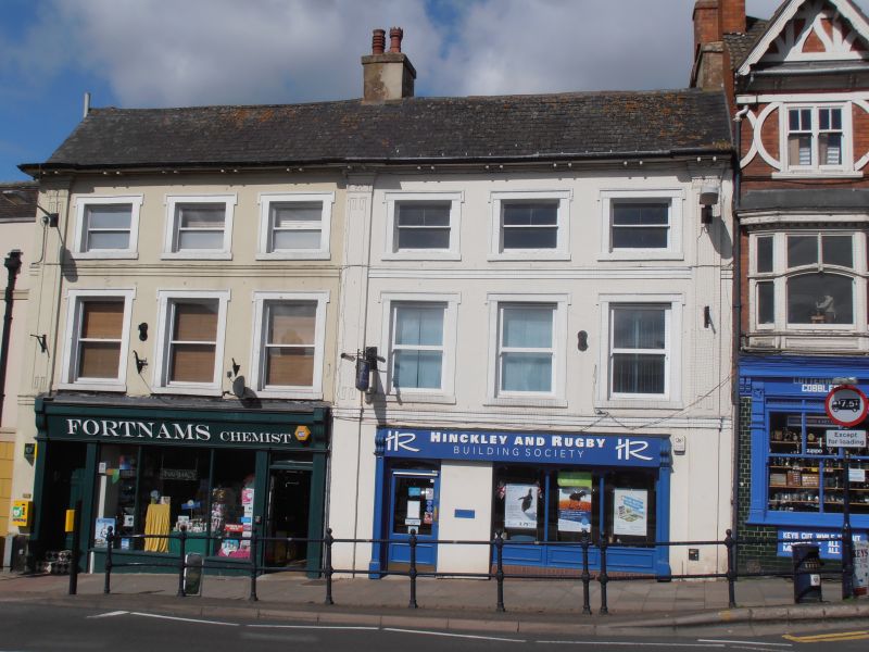
Pair of houses, now shops with accommodation over. Early to mid-C19. Rendered brick; Welsh slate roof. Central ridge stack, also rendered. Two-and-a-half storeys. Regular 6-window range. 3 panelled giant pilasters with anthemion capitals and incised Greek-key motifs divide the front into two equal parts. Deeply overhanging eaves with shaped paired brackets. 1st and upper half storey with 2-pame horned and hornless sashes in reveals with moulded eared architraves and plain sills. Moulded band between storeys. Late-C19 frame to shop front to No.6 (with consoles, pilasters and moulded cornice). Late-C20 shop front to No.4.
Listing NGR: SP5444984466
External links are from the relevant listing authority and, where applicable, Wikidata. Wikidata IDs may be related buildings as well as this specific building. If you want to add or update a link, you will need to do so by editing the Wikidata entry.


Other nearby listed buildings