Latitude: 53.958 / 53°57'28"N
Longitude: -1.0748 / 1°4'29"W
OS Eastings: 460802
OS Northings: 451716
OS Grid: SE608517
Mapcode National: GBR NQYN.3X
Mapcode Global: WHFC3.GSD3
Plus Code: 9C5WXW5G+53
Entry Name: Rowntree Wharf
Listing Date: 24 June 1983
Last Amended: 14 March 1997
Grade: II
Source: Historic England
Source ID: 1257088
English Heritage Legacy ID: 464255
ID on this website: 101257088
Location: Foss Islands, York, North Yorkshire, YO1
County: York
Electoral Ward/Division: Guildhall
Parish: Non Civil Parish
Built-Up Area: York
Traditional County: Yorkshire
Lieutenancy Area (Ceremonial County): North Yorkshire
Church of England Parish: York St Denys
Church of England Diocese: York
Tagged with: Architectural structure
YORK
SE6051NE NAVIGATION ROAD 1112-1/17/796 (West side (off)) 24/06/83 Rowntree Wharf (Formerly Listed as: NAVIGATION ROAD Foss Warehouse)
II
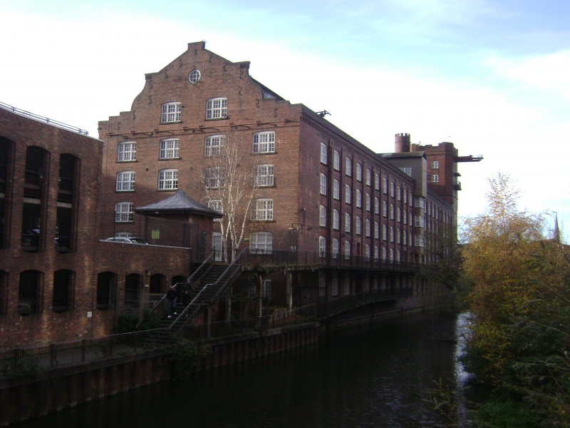
Leetham's flour rolling mills; now flats. 1896, converted c1990. By WG Penty for Sidney Leetham. Orange-brown brick in English garden-wall bond on stone plinth; weather-boarded clerestory with slate roof; moulded stone gable coping and stone string courses; glazed and slated canopy on cast-iron columns. PLAN: Irregular rectangle. EXTERIOR: 5 storeys and set back clerestory attic: 4-bay entrance front with shaped gable to east towards Navigation Road; 20 and one half bays on north side to Foss Navigation; 17-bay south side to Wormald's Cut, linked by canted 3-bay front to 9-storey west tower at confluence of Cut and Navigation. North and south sides articulated by pilaster strips supporting stepped and corbelled frieze and cornice beneath eaves string course and plain brick parapet: canted front on south side is round arcaded beneath stepped parapet. Entrance front has two inserted doors in altered segment-arched openings on ground and first floors, linked on first floor by walkway to adjacent car-park. Other openings are windows and include oculus with glazing bars in gabled attic. Scrolled tie rod ends exposed. North side has cantilevered walkways to ground floor end bays and full width of first floor serving double door entrances. Right of centre bay projects from third floor upwards as gabled lucam, now fenestrated. South side has full-width canopy over ground floor openings. Square west tower has corbelled cornice and eaves string beneath stepped parapet. 6 lower storeys have rounded corners; upper storeys, slightly corbelled out, have canted corners: on south side, embattled turret with vertical slit openings rises through upper 3 storeys. On north side, double doors inserted on first floor open on to walkway. To left, 6- or 8-pane vertical windows light lower storeys. At west end, lower storeys have 3-light windows recessed in tall brick panel: upper storeys have pairs of 2x8-pane casements over sillstring. Throughout, double doors have small-pane glazing and fanlights. Windows are 2- or 3-light small-pane mullioned casements, generally taller on ground floor, with segmental brick arches and stone sills. Windows inserted in former loading bays have shallow balconies with plain balustrades. Gantries and hoists indicating building's original purpose are retained in several places. INTERIOR: not inspected.
Listing NGR: SE6080251716
External links are from the relevant listing authority and, where applicable, Wikidata. Wikidata IDs may be related buildings as well as this specific building. If you want to add or update a link, you will need to do so by editing the Wikidata entry.


Other nearby listed buildings