Latitude: 54.046 / 54°2'45"N
Longitude: -2.8014 / 2°48'5"W
OS Eastings: 347622
OS Northings: 461407
OS Grid: SD476614
Mapcode National: GBR 8PWN.9D
Mapcode Global: WH846.YK5N
Plus Code: 9C6V25WX+9C
Entry Name: 1B, Queen Street
Listing Date: 13 March 1995
Grade: II
Source: Historic England
Source ID: 1212558
English Heritage Legacy ID: 383270
ID on this website: 101212558
Location: Lancaster, Lancashire, LA1
County: Lancashire
District: Lancaster
Electoral Ward/Division: Castle
Parish: Non Civil Parish
Built-Up Area: Lancaster
Traditional County: Lancashire
Lieutenancy Area (Ceremonial County): Lancashire
Church of England Parish: Lancaster St Thomas
Church of England Diocese: Blackburn
Tagged with: Building
LANCASTER
SD4761SE QUEEN STREET 1685-1/8/238 (East side) No.1B
GV II
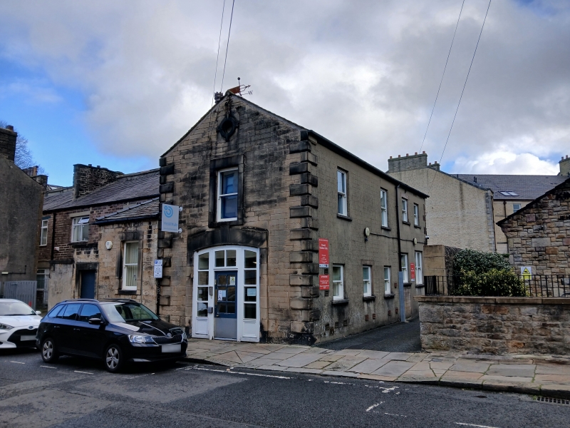
Former coach house to No.1 (qv), now office. Mid C18, altered C20. Sandstone ashlar in narrow courses on the front with coursed rubble, partly rendered to the sides and rear, and a slate roof. Rectangular plan at right angles to the street, with a chimney stack on the left-hand wall. Street front, 2 storeys and one bay with chamfered quoins. The entrance to the coach house is centrally placed and has plain jambs and a segmental arch; directly above this is a C20 casement window, with a blocked owl hole with quadrant keystones in the gable. To the left is a slightly later single-storey extension with a single plain sash. Its roof runs as a catslide from the roof of the coach house, though it is hipped to the front. Included for group value.
Listing NGR: SD4762261407
External links are from the relevant listing authority and, where applicable, Wikidata. Wikidata IDs may be related buildings as well as this specific building. If you want to add or update a link, you will need to do so by editing the Wikidata entry.


Other nearby listed buildings