Latitude: 54.0462 / 54°2'46"N
Longitude: -2.801 / 2°48'3"W
OS Eastings: 347651
OS Northings: 461438
OS Grid: SD476614
Mapcode National: GBR 8PWN.D9
Mapcode Global: WH846.YKCF
Plus Code: 9C6V25WX+FJ
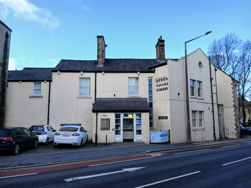
Entry Name: 2, Queen Square
Listing Date: 30 November 1970
Grade: II
Source: Historic England
Source ID: 1195072
English Heritage Legacy ID: 383266
ID on this website: 101195072
Location: Lancaster, Lancashire, LA1
County: Lancashire
District: Lancaster
Electoral Ward/Division: Castle
Parish: Non Civil Parish
Built-Up Area: Lancaster
Traditional County: Lancashire
Lieutenancy Area (Ceremonial County): Lancashire
Church of England Parish: Lancaster St Thomas
Church of England Diocese: Blackburn
Tagged with: Building
LANCASTER
SD4761SE QUEEN SQUARE 1685-1/8/234 (South side) 30/11/70 No.2
GV II
House, now doctors' surgery. Late C18, altered C19 and partly demolished in 1930s. Sandstone ashlar with rendered rear wing at left. Slate roof. Originally double-fronted and of 2 storeys above cellars and 5 bays with a central doorway, and of double-depth plan with a rear extension. Now only the 2 right-hand bays of the facade remain and have sashed windows with plain reveals and projecting sills, and cellar openings. Below the gutter there is a moulded eaves cornice. Set back at the left is a rebuilt bay which has the original doorway re-erected on the ground floor, with 3 external steps, iron railings, and a cornice on console brackets. The upper part of the wall is rendered. To its left is a wall which was also built in the 1930s, splayed back parallel with King Street and connecting the rebuilt facade with the rear wing. Included for group value.
Listing NGR: SD4765161438
External links are from the relevant listing authority and, where applicable, Wikidata. Wikidata IDs may be related buildings as well as this specific building. If you want to add or update a link, you will need to do so by editing the Wikidata entry.


Other nearby listed buildings