Latitude: 54.0426 / 54°2'33"N
Longitude: -2.8027 / 2°48'9"W
OS Eastings: 347536
OS Northings: 461039
OS Grid: SD475610
Mapcode National: GBR 8PWP.1K
Mapcode Global: WH846.XNL6
Plus Code: 9C6V25VW+3W
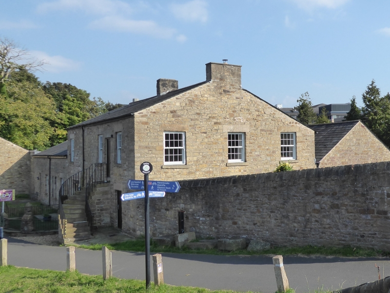
Entry Name: Lancaster Canal Old Blacksmiths Shop Approximately 30 Metres East of Basin Bridge
Listing Date: 13 March 1995
Grade: II
Source: Historic England
Source ID: 1194964
English Heritage Legacy ID: 383031
ID on this website: 101194964
Location: Haverbreaks, Lancaster, Lancashire, LA1
County: Lancashire
District: Lancaster
Electoral Ward/Division: Scotforth West
Parish: Non Civil Parish
Built-Up Area: Lancaster
Traditional County: Lancashire
Lieutenancy Area (Ceremonial County): Lancashire
Church of England Parish: Lancaster St Mary with St John and St Anne
Church of England Diocese: Blackburn
Tagged with: Architectural structure
LANCASTER
SD4761SE ALDCLIFFE ROAD 1685-1/8/2 (East side (off)) Old Blacksmith's Shop, approximately 30 metres east of Basin Bridge
GV II
Blacksmith's shop and dwelling, now used as a store and office. c1800, extended C19 and restored c1991. Built to service traffic on the canal, for the Lancaster Canal Company. Coursed sandstone rubble, slate roof, and chimneys on the original gables. Rectangular plan parallel to the towpath, comprising (to the west) a blacksmith's shop with a dwelling house above it and a stable in an extension to the left, and (to the east) a single-storey workshop or waggon house. The western portion has 2 storeys and 3 x 3 bays. The west gable wall has 3 windows on each floor with recent 36-pane top-hung casements and a doorway in the right-hand corner. The front to the towpath has a window to the left and a doorway to the right on the ground floor and 2 windows with a central doorway on the 1st floor, the door approached up a prominent flight of stone steps, rectangular on plan and protected by iron bar railings. The extension contains a wide blocked doorway with concrete lintel: a new window opening was being made at time of survey. The lower eastern portion has 3 windows and a waggon entrance. INTERIOR: upper floor removed except for principal beams; 2 original fireplaces visible on first floor.
Listing NGR: SD4753661039
External links are from the relevant listing authority and, where applicable, Wikidata. Wikidata IDs may be related buildings as well as this specific building. If you want to add or update a link, you will need to do so by editing the Wikidata entry.


Other nearby listed buildings