Latitude: 54.0421 / 54°2'31"N
Longitude: -2.804 / 2°48'14"W
OS Eastings: 347450
OS Northings: 460979
OS Grid: SD474609
Mapcode National: GBR 8PVP.RS
Mapcode Global: WH846.WNYM
Plus Code: 9C6V25RW+RC
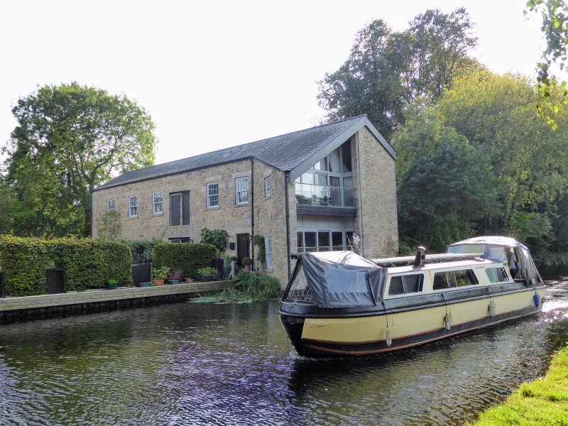
Entry Name: Lancaster Canal Old Boathouse on East Side of Canal Approximately 100 Metres West of Basin Bridge
Listing Date: 30 November 1970
Last Amended: 13 March 1995
Grade: II
Source: Historic England
Source ID: 1194965
English Heritage Legacy ID: 383032
ID on this website: 101194965
Location: Haverbreaks, Lancaster, Lancashire, LA1
County: Lancashire
District: Lancaster
Electoral Ward/Division: Scotforth West
Parish: Non Civil Parish
Built-Up Area: Lancaster
Traditional County: Lancashire
Lieutenancy Area (Ceremonial County): Lancashire
Church of England Parish: Lancaster St Mary with St John and St Anne
Church of England Diocese: Blackburn
Tagged with: Boathouse
LANCASTER
SD46SE ALDCLIFFE ROAD 1685-1/1/3 (East side (off)) 30/11/70 Old Boathouse on east side of Canal, approx. 100m west of Basin Bridge (Formerly Listed as: GENERAL Old Boathouse on Canal at Aldcliffe Road Basin)
GV II
Boathouse and repair workshop, now roofless. c1833, repaired and consolidated c1991. For the Lancaster Canal Company. Roughly coursed sandstone rubble with ashlar dressings. Basically rectangular plan. 2 storeys and 7 bays, built at right angles to the canal around a narrow basin (now silted up). The bay nearest to the canal is splayed outwards to the left to facilitate the passage of boats through a wide full-height entry, off-set to the left. In both side walls the ground-floor openings are irregular, but the 1st floors have 7 windows, which originally had 42 panes. Both floors of the left-hand side wall have, in the middle bay, a doorway with a recess for a sliding door. Between the storeys in each side wall is a row of 13 narrow slots, through which beams were inserted to support boats and a working platform during repairs. HISTORY: built for the accommodation and repair of the fast packet boats 'Waterwitch' and 'Swiftsure', which were supplemented in 1835 by 'Swallow' and in 1839 by 'Crewdson'. These operated a service between Preston and Kendal (57 miles in seven and a quarter hours) from 1833 to 1842, and from Lancaster to Kendal until 1846, in competition with the stage coach. This item is a unique feature of the Lancaster Canal. (Lancaster City Museums Local Studies: White A: Fast Packet Boats on the Lancaster Canal: Lancaster).
Listing NGR: SD4745060979
External links are from the relevant listing authority and, where applicable, Wikidata. Wikidata IDs may be related buildings as well as this specific building. If you want to add or update a link, you will need to do so by editing the Wikidata entry.


Other nearby listed buildings