Latitude: 51.2365 / 51°14'11"N
Longitude: 1.2487 / 1°14'55"E
OS Eastings: 626877
OS Northings: 153611
OS Grid: TR268536
Mapcode National: GBR W06.JHH
Mapcode Global: VHLGX.L5JX
Plus Code: 9F3366PX+JF
Entry Name: Chillenden Court Farm House
Listing Date: 13 October 1952
Grade: II
Source: Historic England
Source ID: 1123706
English Heritage Legacy ID: 177915
ID on this website: 101123706
Location: Chillenden, Dover, Kent, CT3
County: Kent
District: Dover
Civil Parish: Goodnestone
Traditional County: Kent
Lieutenancy Area (Ceremonial County): Kent
Tagged with: Farmhouse
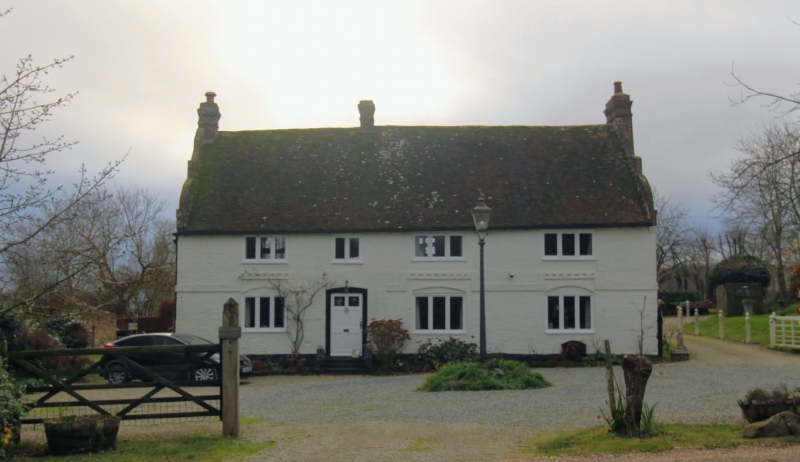
GOODNESTONE CHILLENDEN TR 25 SE 3/54 Chillenden Court Farm House 13.10.52 GV II House. C15, clad c.1700. Timber framed and clad with painted brick with plain tiled roof. Hall house in origin. Two storeys and basement on plinth with plat band raised over window heads. Roof with pedimented Dutch gables and stacks to left, centre left and to right. Three 3 light wooden casements on each floor, with 2 light wooden casement to centre left over door of 6 raised and fielded panels, the top 2 glazed. Basement opening to right. Rear elevation with hipped wing and outshot, with the parapet of the end gable swept down along the edge of outshot. Interior: full frame of very large scantling visible. Inglenook fireplaces and lower half of original newel stair survive.
Listing NGR: TR2698353585
External links are from the relevant listing authority and, where applicable, Wikidata. Wikidata IDs may be related buildings as well as this specific building. If you want to add or update a link, you will need to do so by editing the Wikidata entry.


Other nearby listed buildings