Latitude: 51.2376 / 51°14'15"N
Longitude: 1.2482 / 1°14'53"E
OS Eastings: 626838
OS Northings: 153724
OS Grid: TR268537
Mapcode National: GBR W06.BDX
Mapcode Global: VHLGX.L583
Plus Code: 9F3366QX+27
Entry Name: The Thatch
Listing Date: 17 May 1979
Grade: II
Source: Historic England
Source ID: 1111763
English Heritage Legacy ID: 177917
ID on this website: 101111763
Location: Chillenden, Dover, Kent, CT3
County: Kent
District: Dover
Civil Parish: Goodnestone
Traditional County: Kent
Lieutenancy Area (Ceremonial County): Kent
Tagged with: Building Thatched cottage
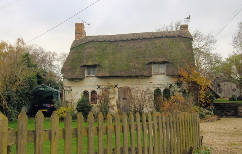
GOODNESTONE CHILLENDEN TR 25 SE 3/56 The Thatch 17.5.79 GV II House. Dated 1706. Painted brick in irregular bond and thatched roof. One storey and attic on plinth with plat band, 2 raking dormers and stacks to left and to right. Two 2 light opening windows and central boarded door with segmental head. Boarded door also in right return. Date stone over door inscribed: IKB 1706
Listing NGR: TR2710053528
External links are from the relevant listing authority and, where applicable, Wikidata. Wikidata IDs may be related buildings as well as this specific building. If you want to add or update a link, you will need to do so by editing the Wikidata entry.


Other nearby listed buildings