Latitude: 51.2377 / 51°14'15"N
Longitude: 1.2511 / 1°15'3"E
OS Eastings: 627036
OS Northings: 153745
OS Grid: TR270537
Mapcode National: GBR W06.C43
Mapcode Global: VHLGX.M5R0
Plus Code: 9F3367Q2+3C
Entry Name: The Grange
Listing Date: 11 October 1963
Grade: II
Source: Historic England
Source ID: 1111772
English Heritage Legacy ID: 177923
ID on this website: 101111772
Location: Chillenden, Dover, Kent, CT3
County: Kent
District: Dover
Civil Parish: Goodnestone
Traditional County: Kent
Lieutenancy Area (Ceremonial County): Kent
Tagged with: Building Thatched cottage
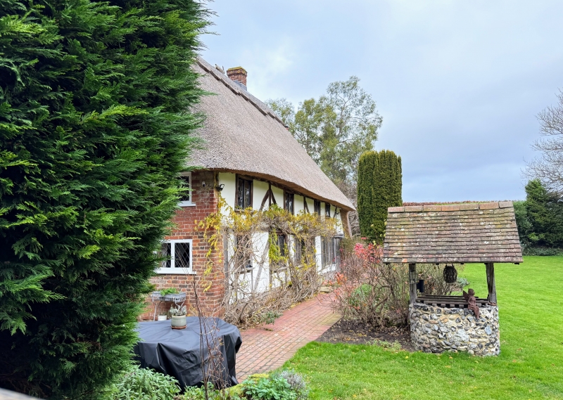
GOODNESTONE CHILLENDEN TR 25 SE 3/62 The Grange 11.10.63 II House. Circa 1400. Timber framed and exposed large panel frame with plaster infill. Thatched roof with pantiled outshot to rear. End jettied hall house plan of 4 framed bays. Two storeys on flint base with evidence (brackets) of underbuilt end jetties with hipped roof and stacks to centre right and end right, this offset with the base of flints and standing against a brick outshot. Four wooden casements on first floor, and 3 on ground floor with large oriel-style window, all C20. Central rib and stud door in four centred arched surround with sidelights. Interior: roof of collared rafters with no longitudinal members. rear outshot conceals lower half of mullioned hall window. (See R.CH.M. report 1969).
Listing NGR: TR2703653745
External links are from the relevant listing authority and, where applicable, Wikidata. Wikidata IDs may be related buildings as well as this specific building. If you want to add or update a link, you will need to do so by editing the Wikidata entry.


Other nearby listed buildings