Latitude: 51.9157 / 51°54'56"N
Longitude: -2.0492 / 2°2'57"W
OS Eastings: 396714
OS Northings: 224129
OS Grid: SO967241
Mapcode National: GBR 2LZ.YHY
Mapcode Global: VHB1Q.F3KR
Plus Code: 9C3VWX82+78
Entry Name: Owlpen
Listing Date: 4 July 1960
Grade: II
Source: Historic England
Source ID: 1091930
English Heritage Legacy ID: 134446
ID on this website: 101091930
Location: Prestbury, Cheltenham, Gloucestershire, GL52
County: Gloucestershire
District: Cheltenham
Civil Parish: Prestbury
Built-Up Area: Cheltenham
Traditional County: Gloucestershire
Lieutenancy Area (Ceremonial County): Gloucestershire
Church of England Parish: Prestbury St Mary
Church of England Diocese: Gloucester
Tagged with: Building
SO 9624 PRESTBURY THE BURGAGE (west side)
17/42 No 49 (Owlpen)
4.7.60
GV II
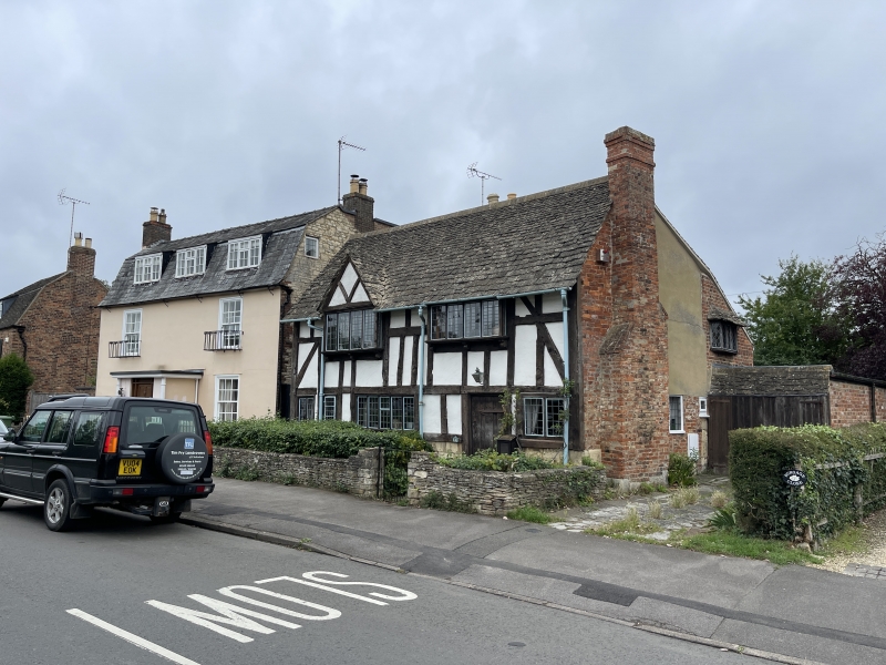
Detached house. C17, restored and extended C20. Close-studded and square-panelled timber framing with rendered infill on plinth of large blocks of coursed squared and dressed limestone. Right gable end and projecting stack brick. Stone slate roof. Rectangular plan to main body with later extension at rear. Garage attached right not of special interest. Main body; 2 storeys with single light, 2 and 5-light casements to ground floor. Two 4-light casements project slightly from first floor. Both first floor windows supported on moulded wooden brackets. Timber-framed gable over left-hand casement. Early plank door with decorative strap hinges and early thumb latch within a beaded heavy-pegged frame with carved decoration comprising a four petalled motif at centre top. Interior not inspected.
Listing NGR: SO9671424129
External links are from the relevant listing authority and, where applicable, Wikidata. Wikidata IDs may be related buildings as well as this specific building. If you want to add or update a link, you will need to do so by editing the Wikidata entry.


Other nearby listed buildings