Latitude: 53.2659 / 53°15'57"N
Longitude: -1.4883 / 1°29'17"W
OS Eastings: 434228
OS Northings: 374443
OS Grid: SK342744
Mapcode National: GBR LZ1N.LZ
Mapcode Global: WHDF8.35KM
Plus Code: 9C5W7G86+9M
Entry Name: Wilkin Hill Pinfold
Listing Date: 31 January 1967
Grade: II
Source: Historic England
Source ID: 1087803
English Heritage Legacy ID: 79497
ID on this website: 101087803
Location: Barlow, North East Derbyshire, S18
County: Derbyshire
District: North East Derbyshire
Civil Parish: Barlow
Traditional County: Derbyshire
Lieutenancy Area (Ceremonial County): Derbyshire
Church of England Parish: Great Barlow
Church of England Diocese: Derby
Tagged with: Building Animal pound
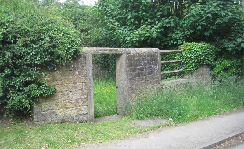
PARISH OF BARLOW WILKIN HILL SK 37 SW 10/15 Wilkin Hill Pinfold 31.1.67 II Pinfold. Early C19. Dressed and rubble coursed coal measures sandstone. Stone walled enclosure, with semi-circular copings, carried across openings as lintels, wooden barred grill to the right of the doorway and a wooden gate in the doorway, with the lintel inscribed '.......... PINFOLD'. The name Barlow was deleted from the lintel during the Second World War, in order to confound enemy troops. Restored 1985.
Listing NGR: SK3422874443
External links are from the relevant listing authority and, where applicable, Wikidata. Wikidata IDs may be related buildings as well as this specific building. If you want to add or update a link, you will need to do so by editing the Wikidata entry.


Other nearby listed buildings