Latitude: 53.2676 / 53°16'3"N
Longitude: -1.4843 / 1°29'3"W
OS Eastings: 434491
OS Northings: 374634
OS Grid: SK344746
Mapcode National: GBR LZ2N.FC
Mapcode Global: WHDF8.54FB
Plus Code: 9C5W7G98+27
Entry Name: The Main Well
Listing Date: 7 July 1989
Last Amended: 22 January 1990
Grade: II
Source: Historic England
Source ID: 1087800
English Heritage Legacy ID: 79489
ID on this website: 101087800
In the entry for - PARISH OF BARLOW HACKNEY LANE (east side)
10/8 The Village Pump The address shall be amended to read - PARISH OF BARLOW MAIN ROAD SK 37 SW 10/8 The Main Well
------------------------------------
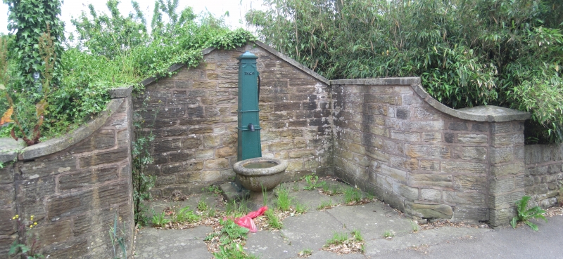
PARISH OF BARLOW HACKNEY LANE SK 37 SW 10/8 (East Side) The Village Pump II Village water pump. 1840. Cast iron obelisk shaped pump, with date at the head, body with a handle and a spout, below which is set a stone trough and plain pedestal. The pump is set within a simple walled enclosure.
Listing NGR: SK3449174634
External links are from the relevant listing authority and, where applicable, Wikidata. Wikidata IDs may be related buildings as well as this specific building. If you want to add or update a link, you will need to do so by editing the Wikidata entry.


Other nearby listed buildings