Latitude: 51.9033 / 51°54'12"N
Longitude: -2.0782 / 2°4'41"W
OS Eastings: 394714
OS Northings: 222759
OS Grid: SO947227
Mapcode National: GBR 2M4.PDB
Mapcode Global: VH947.XFP7
Plus Code: 9C3VWW3C+8P
Entry Name: 47 to 50, St Georges Street
Listing Date: 12 March 1987
Last Amended: 26 November 1998
Grade: II
Source: Historic England
Source ID: 1387859
English Heritage Legacy ID: 475851
ID on this website: 101387859
Location: Cheltenham, Gloucestershire, GL50
County: Gloucestershire
District: Cheltenham
Electoral Ward/Division: St Paul's
Parish: Non Civil Parish
Built-Up Area: Cheltenham
Traditional County: Gloucestershire
Lieutenancy Area (Ceremonial County): Gloucestershire
Church of England Parish: Cheltenham St Paul
Church of England Diocese: Gloucester
Tagged with: Building
CHELTENHAM
SO9422NE ST GEORGE'S STREET 630-1/9/1043 (East side) 12/03/87 Nos.47-50 (Consecutive) (Formerly Listed as: ST GEORGE'S STREET (East side) Nos.46-50)
II
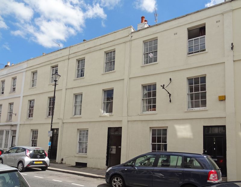
Terrace of 4 houses with shops. c1840. Stucco over brick with parapeted slate roofs and brick stacks. Double depth plan. EXTERIOR: 3 storeys. Each house of 2-window range defined by vertical pilaster strips and horizontal plat and cornice bands. No.48 retains rusticated ground floor, 6/6-pane sashes. No.47 has mid/late C19 multi-pane shop front with margin-glazed overlight over right-hand half-glazed door. No.48 has mid C20 plate-glass shop window and original 4-panel door with overlight to right. Nos 49 & 50 have 4-panel doors with overlights, No.50 retaining late C19 shop front with arched heads to 3-light shop window. INTERIOR: not inspected. The most complete sequence of terraced buildings in the street.
Listing NGR: SO9471022744
External links are from the relevant listing authority and, where applicable, Wikidata. Wikidata IDs may be related buildings as well as this specific building. If you want to add or update a link, you will need to do so by editing the Wikidata entry.


Other nearby listed buildings