Latitude: 51.4966 / 51°29'47"N
Longitude: -0.08 / 0°4'47"W
OS Eastings: 533378
OS Northings: 179267
OS Grid: TQ333792
Mapcode National: GBR VK.5P
Mapcode Global: VHGR0.KNL1
Plus Code: 9C3XFWWC+J2
Entry Name: 15, Grange Walk
Listing Date: 27 September 1972
Last Amended: 17 September 1998
Grade: II
Source: Historic England
Source ID: 1385573
English Heritage Legacy ID: 470976
ID on this website: 101385573
Location: Bermondsey, Southwark, London, SE1
County: London
District: Southwark
Electoral Ward/Division: Grange
Parish: Non Civil Parish
Built-Up Area: Southwark
Traditional County: Surrey
Lieutenancy Area (Ceremonial County): Greater London
Church of England Parish: Bermondsey St Mary Magdalen, St Olave, St John and St Luke
Church of England Diocese: Southwark
Tagged with: Building
SOUTHWARK
TQ3379 GRANGE WALK 636-1/5/391 (South side) 27/09/72 No.15 (Formerly Listed as: GRANGE WALK No.15 St Mary's Youth Centre)
GV II
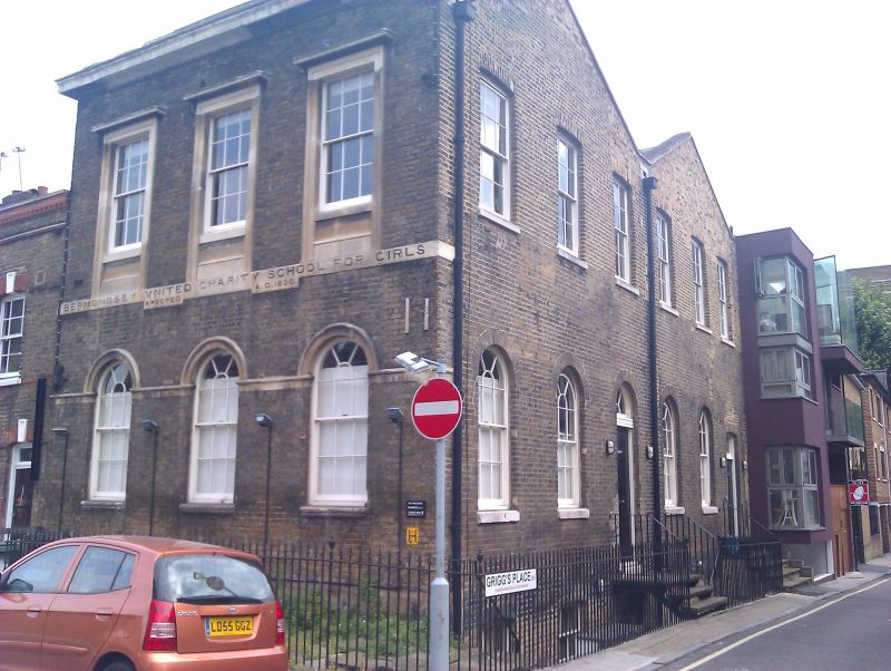
School, later youth centre. Dated 1830. Yellow brick with stone cornice and plinth. Double gable span to 6 bay return which has entrance in end bay. 2 storeys, 3 bays to main elevation. Ground-floor windows are round-headed with stone archivolts and sills. 1st-floor sash windows with glazing bars have moulded stone architraves with cornices and aprons, stone string below inscribed: "Bermondsey United Charity School for Girls, erected AD 1830". Similar fenestration to return but with brick surrounds. INTERIOR: not inspected.
Listing NGR: TQ3337879267
External links are from the relevant listing authority and, where applicable, Wikidata. Wikidata IDs may be related buildings as well as this specific building. If you want to add or update a link, you will need to do so by editing the Wikidata entry.


Other nearby listed buildings