Latitude: 51.2398 / 51°14'23"N
Longitude: 1.2237 / 1°13'25"E
OS Eastings: 625117
OS Northings: 153901
OS Grid: TR251539
Mapcode National: GBR W05.B5J
Mapcode Global: VHLGX.539C
Plus Code: 9F3366QF+WF
Entry Name: Bonnington Cottage
Listing Date: 11 October 1963
Grade: II
Source: Historic England
Source ID: 1363246
English Heritage Legacy ID: 177908
ID on this website: 101363246
Location: Dover, Kent, CT3
County: Kent
District: Dover
Civil Parish: Goodnestone
Traditional County: Kent
Lieutenancy Area (Ceremonial County): Kent
Tagged with: Cottage
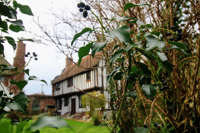
GOODNESTONE BONNINGTON TR 25 SE 3/47 Bonnington 11.10.63 Cottage GV II House. Mid C16 and c.1700. Timber framed and exposed close studding with plaster infill on brick and flint base with left end wall of red brick. Plain tiled roof. Three framed bays. Two storeys on plinth with continuous jetty on all but left end elevation which has a shaped gable. Stacks to left and doubled to centre right. Two 4 light and one 2 light wooden casement to right on first floor and cross window, 2 light wooden casement, 3 light mullioned and transomed window and 2 light wooden casement on ground floor, with rib and stud doors with four centred arched surrounds to centre and to right, and blocked opening to left. To left of house, and joining it to Bonnington Farmhouse, is a courtyard enclosed by a red brick wall 16 feet high on a plinth with a central round-headed gateway between the 2 houses, and about 5 feet high, with 2 gatepiers, enclosing a courtyard about 50 metres by 50 metres to rear left (south of Bonnington Cottage). The cottage originally built as part of the manorial complex of the Boys family at Bonnington.
Listing NGR: TR2511053939
External links are from the relevant listing authority and, where applicable, Wikidata. Wikidata IDs may be related buildings as well as this specific building. If you want to add or update a link, you will need to do so by editing the Wikidata entry.


Other nearby listed buildings