Latitude: 51.2402 / 51°14'24"N
Longitude: 1.2237 / 1°13'25"E
OS Eastings: 625111
OS Northings: 153941
OS Grid: TR251539
Mapcode National: GBR W05.46H
Mapcode Global: VHLGX.5382
Plus Code: 9F3366RF+3F
Entry Name: Gate Lodge
Listing Date: 3 December 1986
Grade: II
Source: Historic England
Source ID: 1070281
English Heritage Legacy ID: 177909
ID on this website: 101070281
Location: Dover, Kent, CT3
County: Kent
District: Dover
Civil Parish: Goodnestone
Traditional County: Kent
Lieutenancy Area (Ceremonial County): Kent
Tagged with: Gatehouse
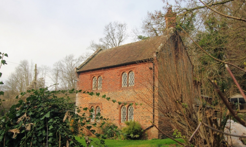
GOODNESTONE BONNINGTON TR 25 SE 3/48 Gate Lodge GV II Gate/Lodge. Circa 1835. Red brick and plain tiled roof. Goodnestone Estate style. Two storeys on plinth with dogtooth cornice to roof with kneelered parapet gables and stack to end right. Projecting gabled wing to right. Two 2 light Dering windows on each floor, and boarded door to centre in recessed round headed porch.
Listing NGR: TR2511053939
External links are from the relevant listing authority and, where applicable, Wikidata. Wikidata IDs may be related buildings as well as this specific building. If you want to add or update a link, you will need to do so by editing the Wikidata entry.


Other nearby listed buildings