Latitude: 51.2514 / 51°15'5"N
Longitude: 1.2358 / 1°14'8"E
OS Eastings: 625903
OS Northings: 155224
OS Grid: TR259552
Mapcode National: GBR W00.F86
Mapcode Global: VHLGQ.CTP1
Plus Code: 9F33762P+H8
Entry Name: The Old Malthouse
Listing Date: 13 May 1986
Grade: II
Source: Historic England
Source ID: 1337668
English Heritage Legacy ID: 177912
ID on this website: 101337668
Location: Goodnestone, Dover, Kent, CT3
County: Kent
District: Dover
Civil Parish: Goodnestone
Traditional County: Kent
Lieutenancy Area (Ceremonial County): Kent
Tagged with: Architectural structure
GOODNESTONE CAVE LANE TR 25 NE 1/51 The Old Malthouse 13.5.86
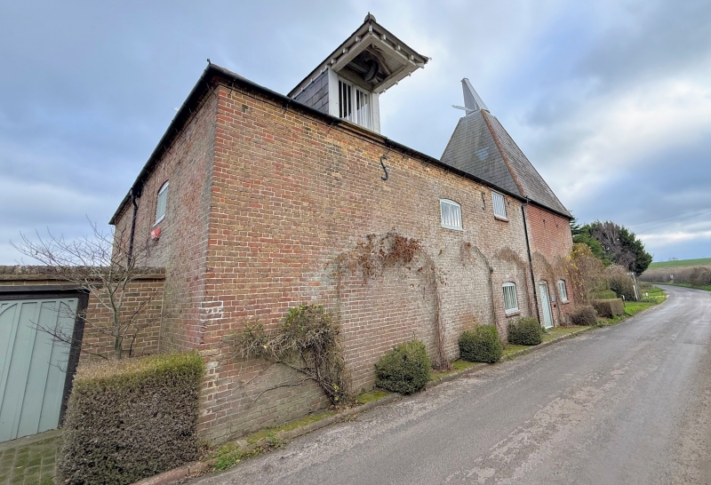
GV II Maltings and oasts. Early to mid C19. Red brick and slate roofed. Two square kilns with pyramidal roofs set at opposite corners of an earlier stowage building, with irregular fenestration of segmental wooden casements, 1 each at 3 levels, with boarded doors to left and in left hand kiln. Rear wing, 2 storeys with hipped roof and 5 segmentally headed wooden casements. Interior: includes contemporary machinery : gin wheel and well house, hop press.
Listing NGR: TR2588755239
External links are from the relevant listing authority and, where applicable, Wikidata. Wikidata IDs may be related buildings as well as this specific building. If you want to add or update a link, you will need to do so by editing the Wikidata entry.


Other nearby listed buildings