Latitude: 51.2491 / 51°14'56"N
Longitude: 1.2308 / 1°13'50"E
OS Eastings: 625564
OS Northings: 154949
OS Grid: TR255549
Mapcode National: GBR W00.L07
Mapcode Global: VHLGQ.9V1T
Plus Code: 9F3366XJ+J8
Entry Name: North Corner
Listing Date: 3 December 1986
Grade: II
Source: Historic England
Source ID: 1336988
English Heritage Legacy ID: 177944
ID on this website: 101336988
Location: Goodnestone, Dover, Kent, CT3
County: Kent
District: Dover
Civil Parish: Goodnestone
Traditional County: Kent
Lieutenancy Area (Ceremonial County): Kent
Tagged with: Building
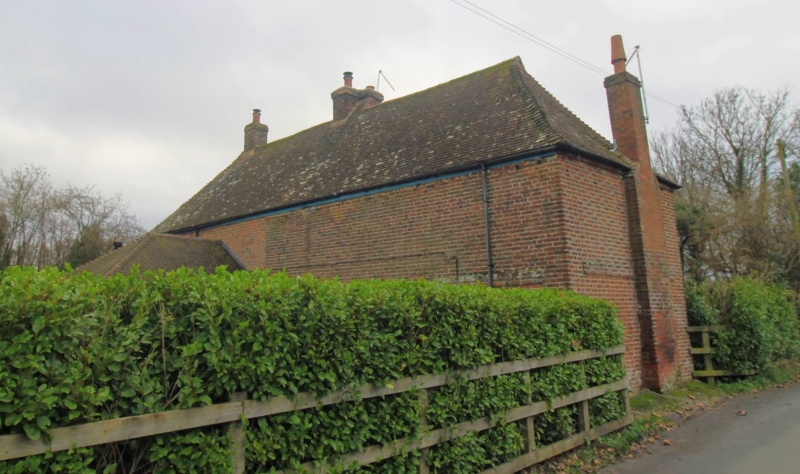
GOODNESTONE SADDLER'S HILL TR 25 SE (north side) 3/83 Nos. 1 and 2 North Corner GV II House, now house pair. Exterior dated 1778 to earlier building. Timber framed and clad with red brick and red and blue brick with plain tiled roof. Two storeys and attic on plinth with discontinuous plat band to left half only with hipped roof and gablets. Two flat roofed dormers and stacks to right, to centre and projecting and rebuilt at end left. Three wooden case- ments on first floor, and 2 glazing bar sashes, 1 wooden casement and 1 blocked opening on ground floor, all with segmental heads. Door of 6 raised and fielded panels to left with flat hood on brackets. Dated over door: 1778.
Listing NGR: TR2555754946
External links are from the relevant listing authority and, where applicable, Wikidata. Wikidata IDs may be related buildings as well as this specific building. If you want to add or update a link, you will need to do so by editing the Wikidata entry.


Other nearby listed buildings