Latitude: 51.2475 / 51°14'50"N
Longitude: 1.2316 / 1°13'53"E
OS Eastings: 625630
OS Northings: 154773
OS Grid: TR256547
Mapcode National: GBR W00.L7D
Mapcode Global: VHLGQ.9XG2
Plus Code: 9F3366WJ+XM
Entry Name: The Old Post Office
Listing Date: 13 October 1962
Grade: II
Source: Historic England
Source ID: 1363237
English Heritage Legacy ID: 177967
ID on this website: 101363237
Location: Goodnestone, Dover, Kent, CT3
County: Kent
District: Dover
Civil Parish: Goodnestone
Traditional County: Kent
Lieutenancy Area (Ceremonial County): Kent
Tagged with: Post office Thatched cottage
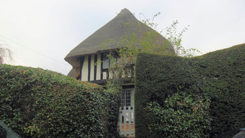
GOODNESTONE THE STREET TR 25 SE (west side) 3/106 The Old Post 13.10.62 Office GV II House. C15. Timber framed and exposed close studding with plaster infill with thatched roof. Two storeys and end jetty (towards road). Hipped roof with central stack cluster. Three wooden casements on each floor and boarded door to centre left. Outshot to rear in painted brick. At some time the rectory (See Igglesden, 19, p.35), and possibly the building given for the use of the vicar by Gabriel Richards, 1671 (see the Richards Charity buildings), although this may also relate to the late C17 parsonage.
Listing NGR: TR2563054771
External links are from the relevant listing authority and, where applicable, Wikidata. Wikidata IDs may be related buildings as well as this specific building. If you want to add or update a link, you will need to do so by editing the Wikidata entry.


Other nearby listed buildings