Latitude: 50.7913 / 50°47'28"N
Longitude: -1.1043 / 1°6'15"W
OS Eastings: 463231
OS Northings: 99466
OS Grid: SZ632994
Mapcode National: GBR VNY.GQ
Mapcode Global: FRA 87K0.5M3
Plus Code: 9C2WQVRW+G7
Entry Name: 17, Lombard Street
Listing Date: 25 September 1972
Grade: II
Source: Historic England
Source ID: 1333446
English Heritage Legacy ID: 474914
ID on this website: 101333446
Location: Old Portsmouth, Portsmouth, Hampshire, PO1
County: City of Portsmouth
Electoral Ward/Division: St Thomas
Parish: Non Civil Parish
Built-Up Area: Portsmouth
Traditional County: Hampshire
Lieutenancy Area (Ceremonial County): Hampshire
Church of England Parish: St Thomas of Canterbury, Portsmouth
Church of England Diocese: Portsmouth
Tagged with: Building
PORTSMOUTH
SZ6399 LOMBARD STREET 774-1/12/62 (South West side) 25/09/72 No.17
GV II
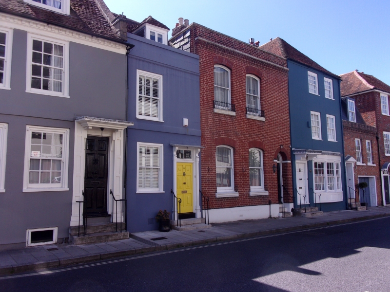
House. Early/mid C19 front to C18 building. Red brick in Flemish bond. Hipped plain tile roof, brick stack at centre. 2 storeys, 2 bays. Door to left with 6 moulded panels in reeded doorcase with semicircular fanlight over, flanking brick jambs, round brick arch over with brick keystone. 3 stone steps to doorway with flanking guard rails. To left and first floor 2 sashes, set under segmental brick arches. Panelled fronts to projecting window sills with attached metal window guards. Brick dentil band over first floor with stone cap. Stone coped parapet. INTERIOR not inspected.
Listing NGR: SZ6322899465
External links are from the relevant listing authority and, where applicable, Wikidata. Wikidata IDs may be related buildings as well as this specific building. If you want to add or update a link, you will need to do so by editing the Wikidata entry.


Other nearby listed buildings