Latitude: 50.7913 / 50°47'28"N
Longitude: -1.1042 / 1°6'15"W
OS Eastings: 463235
OS Northings: 99458
OS Grid: SZ632994
Mapcode National: GBR VNY.GR
Mapcode Global: FRA 87K0.5M4
Plus Code: 9C2WQVRW+G8
Entry Name: The Greye House
Listing Date: 30 October 1969
Last Amended: 18 March 1999
Grade: II
Source: Historic England
Source ID: 1333442
English Heritage Legacy ID: 474910
ID on this website: 101333442
Location: Old Portsmouth, Portsmouth, Hampshire, PO1
County: City of Portsmouth
Electoral Ward/Division: St Thomas
Parish: Non Civil Parish
Built-Up Area: Portsmouth
Traditional County: Hampshire
Lieutenancy Area (Ceremonial County): Hampshire
Church of England Parish: St Thomas of Canterbury, Portsmouth
Church of England Diocese: Portsmouth
Tagged with: House
PORTSMOUTH
SZ6399 LOMBARD STREET 774-1/12/60 (South West side) 30/10/69 No.13 The Greye House (Formerly Listed as: LOMBARD STREET No.13)
GV II
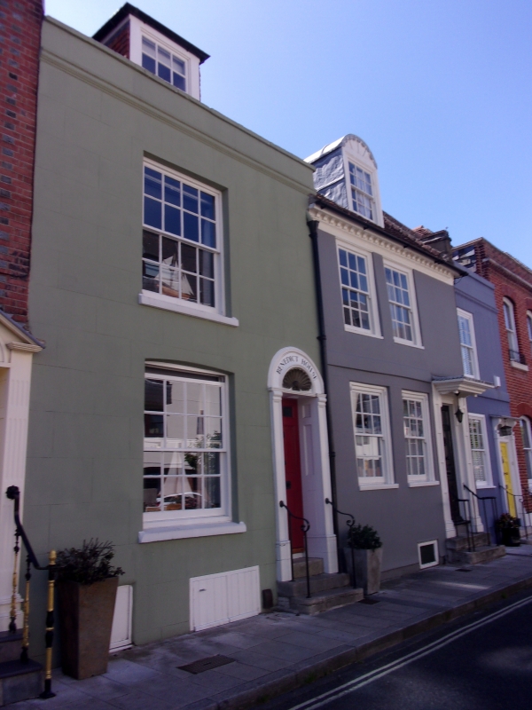
House. Mid C18, altered. Painted brickwork rendered below ground floor window sills. Plain tile roof and brick stack central on rear roof pitch. 2 storeys and attic, 2 bays. Door to right with 6 fielded panels, upper 2 glazed, panelled surround and flat hood with shaped brackets over. On left and on first floor, two 12-pane sashes. Brick band course at first floor. Modillion eaves cornice at roof. Round headed dormer. Roof runs through with No.11 (qv). INTERIOR not inspected. (The Buildings of England: Pevsner N & Lloyd DW: Hampshire and the Isle of Wight: Harmondsworth: 1967-: 453).
Listing NGR: SZ6323199456
External links are from the relevant listing authority and, where applicable, Wikidata. Wikidata IDs may be related buildings as well as this specific building. If you want to add or update a link, you will need to do so by editing the Wikidata entry.


Other nearby listed buildings