Latitude: 50.9466 / 50°56'47"N
Longitude: -2.5182 / 2°31'5"W
OS Eastings: 363693
OS Northings: 116477
OS Grid: ST636164
Mapcode National: GBR MT.NRTQ
Mapcode Global: FRA 56ML.SY2
Plus Code: 9C2VWFWJ+JP
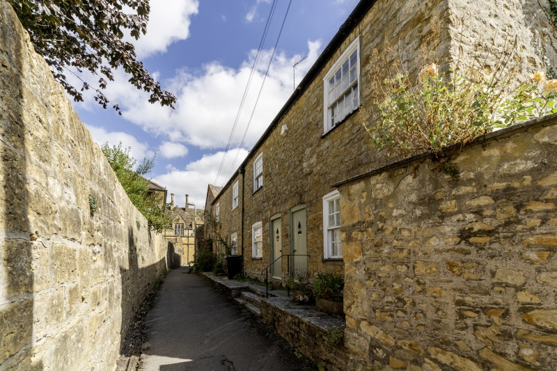
Entry Name: 3-6, Finger Lane
Listing Date: 4 October 1973
Grade: II
Source: Historic England
Source ID: 1324356
English Heritage Legacy ID: 103953
ID on this website: 101324356
Location: Sherborne, Dorset, DT9
County: Dorset
Civil Parish: Sherborne
Built-Up Area: Sherborne
Traditional County: Dorset
Lieutenancy Area (Ceremonial County): Dorset
Church of England Parish: Sherborne with Castleton Abbey Church of St Mary
Church of England Diocese: Salisbury
Tagged with: Building
FINGER LANE 1. 1625 Nos 3 to 6 (consec) ST 6316 1/83A II GV C19. 2 storeys. 4 window bays. [One each]. Slate gabled roof. Stone rubble fronts. Sash windows with glazing bars intact; slightly segmental headed. Segmental headed doorways; ledged doors in frames.
Nos 1, 2, Gospel Hall, Nos 3 to 6 (consec) and garden wall to Pineska in Acreman Street form a group.
Listing NGR: ST6369816479
External links are from the relevant listing authority and, where applicable, Wikidata. Wikidata IDs may be related buildings as well as this specific building. If you want to add or update a link, you will need to do so by editing the Wikidata entry.


Other nearby listed buildings