Latitude: 50.9464 / 50°56'47"N
Longitude: -2.5179 / 2°31'4"W
OS Eastings: 363711
OS Northings: 116459
OS Grid: ST637164
Mapcode National: GBR MT.NRWZ
Mapcode Global: FRA 56ML.T21
Plus Code: 9C2VWFWJ+HR
Entry Name: Vicarage
Listing Date: 28 November 1950
Grade: II
Source: Historic England
Source ID: 1324311
English Heritage Legacy ID: 103820
ID on this website: 101324311
Location: Sherborne, Dorset, DT9
County: Dorset
Civil Parish: Sherborne
Built-Up Area: Sherborne
Traditional County: Dorset
Lieutenancy Area (Ceremonial County): Dorset
Church of England Parish: Sherborne with Castleton Abbey Church of St Mary
Church of England Diocese: Salisbury
Tagged with: Clergy house
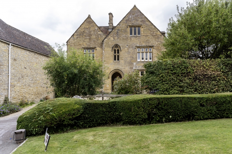
ABBEY CLOSE 1. 1625 Vicarage ST 6316 1/12A 28.11.50. II GV 2. 1878; built further back on the same site as the medieval vicarage which was demolished in that year, said to incorporate same medieval remains. 2 storeys and attic. 3 windows bays. Plain tile roof. Ashlar front. Stone-mullioned windows. Left hand bay has 3-light transomed window to first floor with gable over first floor; larger 3-light similar window to ground floor. Large gable over centre and right hand bays. Attic window with dripmould. Centre bay has 2-light perpendicular style windows on first floor, and, on ground floor, porch with four-centred headed doorway. Door of 6 panels with 3 longitudinal glazed panels in upper part. To right hand bay, 4-light transomed window with dripstone; larger window of same style below this on ground floor.
All the listed buildings in Abbey Close form a group with the east end of No 1 Finger Lane.
Listing NGR: ST6370816459
External links are from the relevant listing authority and, where applicable, Wikidata. Wikidata IDs may be related buildings as well as this specific building. If you want to add or update a link, you will need to do so by editing the Wikidata entry.


Other nearby listed buildings