Latitude: 51.4863 / 51°29'10"N
Longitude: -2.5059 / 2°30'21"W
OS Eastings: 364965
OS Northings: 176496
OS Grid: ST649764
Mapcode National: GBR CW6.Z1
Mapcode Global: VH88H.JW2Y
Plus Code: 9C3VFFPV+GJ
Entry Name: Christ Church
Listing Date: 15 July 1981
Grade: II
Source: Historic England
Source ID: 1320055
English Heritage Legacy ID: 28781
Also known as: Christ Church, Downend
ID on this website: 101320055
Location: Christ Church, Mangotsfield, South Gloucestershire, BS16
County: South Gloucestershire
Civil Parish: Downend and Bromley Heath
Built-Up Area: Bristol
Traditional County: Gloucestershire
Lieutenancy Area (Ceremonial County): Gloucestershire
Church of England Parish: Downend
Church of England Diocese: Bristol
Tagged with: Church building
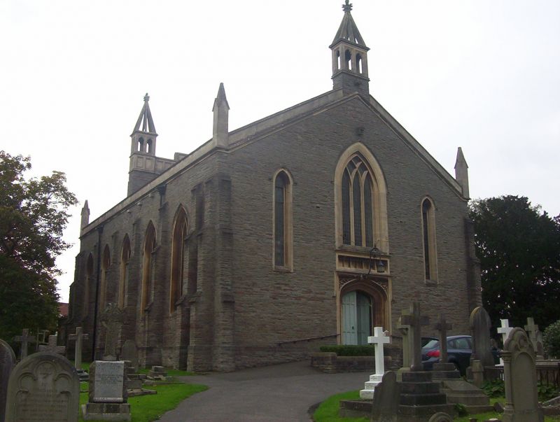
1. 5118 EX-MANGOTSFIELD UD DOWNEND ROAD (south side) Christ Church ST 67 NW 1/185 II 2. 1831, by Oliver Greenway, local architect. Chancel 1914. Coursed pennant rubble with ashlar dressings, slate roof (chancel tiled), west end has coped gable with side pinnacles and a 2-light belfry with a pierced spirelet, angle buttresses and 2 side lancets. Central 3-light pointed window with intersecting tracery. Tudor arch doorway with panelled doors and carved spandrel. Five bay nave with ashlar parapet, 3-light lancets with intersecting tracery and headstops to labels. Dividing buttresses. Two bay chancel and tower vestry to north-east. Tower chapel to south-east. Rose window to east. Most prominent feature is panelled screen on roof above chancel arch with side belfries and pierced spirelets. Interior: wide auditorium type.
Listing NGR: ST6496576496
External links are from the relevant listing authority and, where applicable, Wikidata. Wikidata IDs may be related buildings as well as this specific building. If you want to add or update a link, you will need to do so by editing the Wikidata entry.


Other nearby listed buildings