Latitude: 51.4867 / 51°29'11"N
Longitude: -2.509 / 2°30'32"W
OS Eastings: 364754
OS Northings: 176534
OS Grid: ST647765
Mapcode National: GBR CW5.9X
Mapcode Global: VH88H.GWGQ
Plus Code: 9C3VFFPR+MC
Entry Name: 86, Downend Road
Listing Date: 15 July 1981
Grade: II
Source: Historic England
Source ID: 1116221
English Heritage Legacy ID: 28783
ID on this website: 101116221
Location: Mangotsfield, South Gloucestershire, BS16
County: South Gloucestershire
Civil Parish: Downend and Bromley Heath
Built-Up Area: Bristol
Traditional County: Gloucestershire
Lieutenancy Area (Ceremonial County): Gloucestershire
Church of England Parish: Downend
Church of England Diocese: Bristol
Tagged with: Building
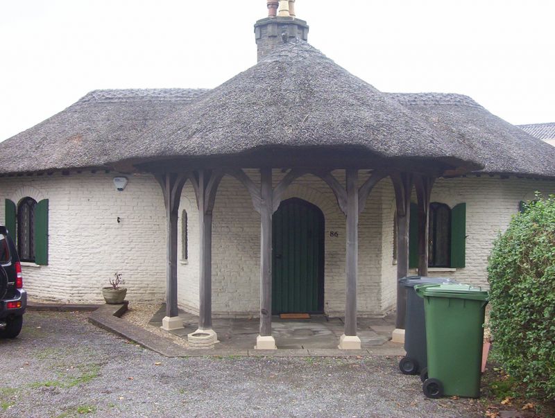
1. 5118 EX-MANGOTSFIELD UD DOWNEND ROAD (north side) No 86 ST 67 NW 1/186 II 2. Early C19, single storey turnpike cottage. Rendered with modern pantile roof. Central octagonal chimney with simple modillion capping. In plan a cross with angled end bays. South wing has recessed angled bay with entrance and projecting angled porch verandah under continuous hipped roof. Y tracery and shutters to windows on angles of bays, segment headed sash windows. Battened Tudor arch doorway.
Listing NGR: ST6475476534
External links are from the relevant listing authority and, where applicable, Wikidata. Wikidata IDs may be related buildings as well as this specific building. If you want to add or update a link, you will need to do so by editing the Wikidata entry.


Other nearby listed buildings