Latitude: 54.404 / 54°24'14"N
Longitude: -1.7308 / 1°43'50"W
OS Eastings: 417572
OS Northings: 500976
OS Grid: NZ175009
Mapcode National: GBR JKCJ.22
Mapcode Global: WHC6D.DK1Q
Plus Code: 9C6WC739+HM
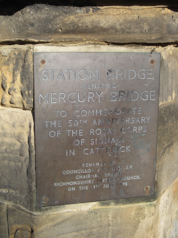
Entry Name: Mercury Bridge
Listing Date: 4 February 1969
Last Amended: 6 November 1986
Grade: II
Source: Historic England
Source ID: 1317112
English Heritage Legacy ID: 322177
ID on this website: 101317112
Location: Anchorage Hill, North Yorkshire, DL10
County: North Yorkshire
District: Richmondshire
Civil Parish: St. Martin's
Traditional County: Yorkshire
Lieutenancy Area (Ceremonial County): North Yorkshire
Church of England Parish: Richmond with Holy Trinity with Hudswell
Church of England Diocese: Leeds
Tagged with: Bridge
ST MARTINS A 6136 NZ 10 SE
4/111 Mercury Bridge (formerly listed as 4.2.69 Station Bridge (that half in Richmond Rural District))
GV II
Marked on Ordnance Survey Map as Station Bridge. Bridge. c1846. By G T Andrews for George Hudson's Great North of England Railway. Rock-faced sandstone ashlar. Four segmental-pointed double-chamfered arches, under continuous label with shields over centre of piers. Small cutwaters to piers. Lombard frieze to parapet, supporting triangular coping with rolled ridge, and hollow-chamfered outer slope and double-coursed inner slope. Over each pier, corbelled bases formerly to pinnacles carrying gas-lamps, pinnacles all demolished except for part of southernmost one on upstream parapet. Octagonal terminals to parapets, with corniced moulded conical caps. Originally built to give vehicular access to the Railway Station from the town of Richmond on the other side of the River Swale, but during World War I the road was extended by Italian prisoners of war to give access to Catterick Camp, then under construction. Biddle G & Nock O S, The Railway Heritage of Britain (1983), p 38. Partly in Richmond Parish. One of an important surviving group of railway buildings.
Listing NGR: NZ1757200976
External links are from the relevant listing authority and, where applicable, Wikidata. Wikidata IDs may be related buildings as well as this specific building. If you want to add or update a link, you will need to do so by editing the Wikidata entry.


Other nearby listed buildings