Latitude: 54.1313 / 54°7'52"N
Longitude: -0.1775 / 0°10'38"W
OS Eastings: 519184
OS Northings: 472143
OS Grid: TA191721
Mapcode National: GBR WN6N.CS
Mapcode Global: WHHF1.7FR6
Plus Code: 9C6X4RJF+G2
Entry Name: Bempton House
Listing Date: 19 October 1984
Last Amended: 2 January 1985
Grade: II
Source: Historic England
Source ID: 1309885
English Heritage Legacy ID: 166789
ID on this website: 101309885
Location: Bempton, East Riding of Yorkshire, YO15
County: East Riding of Yorkshire
Civil Parish: Bempton
Built-Up Area: Bempton
Traditional County: Yorkshire
Lieutenancy Area (Ceremonial County): East Riding of Yorkshire
Church of England Parish: Bempton St Michael
Church of England Diocese: York
Tagged with: House
TA 17 SE BEMPTON POOR PEOPLES LANE (east side)
6/17 Bempton House (Formerly listed under 19.10.84 St. Michaels Walk) - II
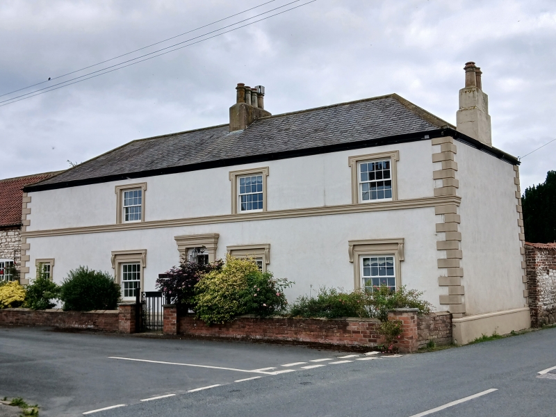
House. C18, refronted early C19. Rendered, stone dressings, timber eaves cornice with paired brackets, slate roof. L-shaped plan, central lobby-entry. 2 storeys, 3 window front. Moulded stone plinth, rusticated quoins. 4-panel door under oblong fanlight with panelled reveals and soffit in pilastered doorcase with flat hood. Ground floor windows have moulded stone architraves with chambranles, and moulded sills and cornices on consoles. Moulded first floor sill band. First floor windows have eared architraves. 16-pane sashes throughout. Hipped roof with axial stack and end stack with one offset. Interior not inspected.
Listing NGR: TA1918472143
External links are from the relevant listing authority and, where applicable, Wikidata. Wikidata IDs may be related buildings as well as this specific building. If you want to add or update a link, you will need to do so by editing the Wikidata entry.


Other nearby listed buildings