Latitude: 54.1301 / 54°7'48"N
Longitude: -0.1789 / 0°10'44"W
OS Eastings: 519094
OS Northings: 472006
OS Grid: TA190720
Mapcode National: GBR WN6P.27
Mapcode Global: WHHF1.7G24
Plus Code: 9C6X4RJC+2C
Entry Name: Manor Farmhouse
Listing Date: 2 January 1985
Grade: II
Source: Historic England
Source ID: 1083414
English Heritage Legacy ID: 166788
ID on this website: 101083414
Location: Bempton, East Riding of Yorkshire, YO15
County: East Riding of Yorkshire
Civil Parish: Bempton
Built-Up Area: Bempton
Traditional County: Yorkshire
Lieutenancy Area (Ceremonial County): East Riding of Yorkshire
Church of England Parish: Bempton St Michael
Church of England Diocese: York
Tagged with: Farmhouse
TA 17 SE BEMPTON NEWSHAM HILL LANE (east side)
6/15 Manor Farmhouse -
- II
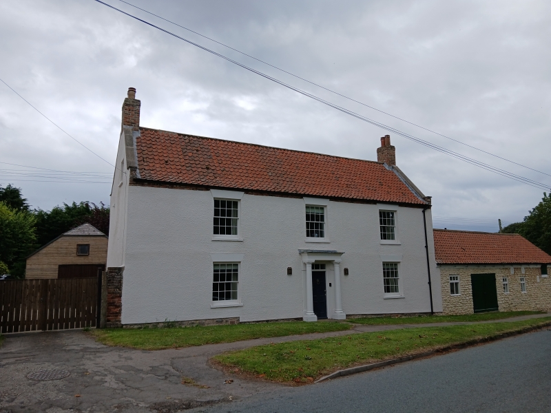
House. Early C19. Coursed chalk rubble,rendered, pantiled roof, brick stacks. Symmetrical elevation, 2 storeys and attics, 3 bays. C20 door in wooden architrave concealed by C20 conservatory porch. 16-pane sashes. End stacks, gables with plain close verges. Interior not inspected: steep roofline and proportions of house suggest that existing elevations are refronting of an older building.
Listing NGR: TA1909472006
External links are from the relevant listing authority and, where applicable, Wikidata. Wikidata IDs may be related buildings as well as this specific building. If you want to add or update a link, you will need to do so by editing the Wikidata entry.


Other nearby listed buildings