Latitude: 51.9911 / 51°59'28"N
Longitude: -1.7465 / 1°44'47"W
OS Eastings: 417504
OS Northings: 232552
OS Grid: SP175325
Mapcode National: GBR 4P8.38D
Mapcode Global: VHB1H.P62X
Plus Code: 9C3WX7R3+FC
Entry Name: Hillside
Listing Date: 25 August 1960
Last Amended: 11 January 1985
Grade: II
Source: Historic England
Source ID: 1305323
English Heritage Legacy ID: 128684
ID on this website: 101305323
Location: Bourton-on-the-Hill, Cotswold, Gloucestershire, GL56
County: Gloucestershire
District: Cotswold
Civil Parish: Bourton-on-the-Hill
Traditional County: Gloucestershire
Lieutenancy Area (Ceremonial County): Gloucestershire
Church of England Parish: Bourton-on-the-Hill St Lawrence
Church of England Diocese: Gloucester
Tagged with: Building
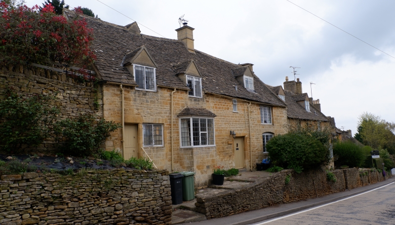
BOURTON-ON-THE-HILL MAIN STREET SP 1732 (north side) 10/46 Hillside (formerly listed as The Bank) 25.8.60 GV II Formerly 2 cottages semi-detached now in single occupation. C18. Coursed squared and dressed limestone, limestone slate roof with limestone gable end coping, one ashlar and one artificial stone stack. Rectangular plan with short gabled projection rear left 2 storeys and attic lit by three 2-light dormers across eaves; roof dormer right. Ground floor narrow panelled door up 6 steps far left with plain flat-chamfered surround. 2-light C19/20 window right; canted 5-light bay window with limestone slate roof right; plank door with cover strips in flat-chamfered surround left with C20 2-light frosted glass window over. Two 3-light casements far right, segmental head over the lower window. Mostly late C19/early C20 metal casements with leaded lights. Slightly stepped coping on gable end. Single right gable end stack with moulded capping. C20 artificial stone stack replacing former ashlar stack off centre left. Interior not inspected.
Listing NGR: SP1750932550
External links are from the relevant listing authority and, where applicable, Wikidata. Wikidata IDs may be related buildings as well as this specific building. If you want to add or update a link, you will need to do so by editing the Wikidata entry.


Other nearby listed buildings