Latitude: 51.9911 / 51°59'28"N
Longitude: -1.7463 / 1°44'46"W
OS Eastings: 417517
OS Northings: 232548
OS Grid: SP175325
Mapcode National: GBR 4P8.3BM
Mapcode Global: VHB1H.P65Y
Plus Code: 9C3WX7R3+CF
Entry Name: Sundial Cottage
Listing Date: 25 August 1960
Grade: II
Source: Historic England
Source ID: 1089557
English Heritage Legacy ID: 128683
ID on this website: 101089557
Location: Bourton-on-the-Hill, Cotswold, Gloucestershire, GL56
County: Gloucestershire
District: Cotswold
Civil Parish: Bourton-on-the-Hill
Traditional County: Gloucestershire
Lieutenancy Area (Ceremonial County): Gloucestershire
Church of England Parish: Bourton-on-the-Hill St Lawrence
Church of England Diocese: Gloucester
Tagged with: Cottage
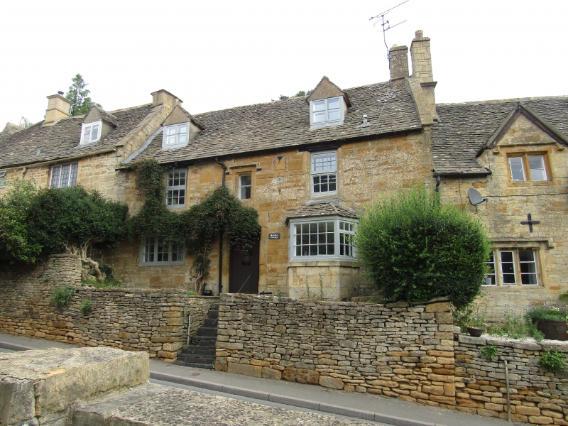
BOURTON-ON-THE-HILL MAIN STREET SP 1732 (north side) 10/45 Sundial Cottage 25.8.60 GV II Small house in row of 3. Late Cl7-early C18. Coursed squared and dressed limestone, limestone slate roof with limestone coping and artificial stone stack. Rectangular plan. 2 storeys and attic lit by two 2-light C20 roof dormers. 3-windowed. First floor left to right: 12-pane sash; 2-light fixed casement with stopped hood; 12- pane wood casement. Ground floor left to right: C20 3-light wood casement; central C20 part-glazed plank door in flat-chamfered arched surround; 5-light canted bay far right. Sundial with painted black figures at first floor level. Sun insurance plaque below. Flat gable end coping and stack at right gable end. Interior not inspected.
Listing NGR: SP1750832550
External links are from the relevant listing authority and, where applicable, Wikidata. Wikidata IDs may be related buildings as well as this specific building. If you want to add or update a link, you will need to do so by editing the Wikidata entry.


Other nearby listed buildings