Latitude: 51.2842 / 51°17'3"N
Longitude: -2.0549 / 2°3'17"W
OS Eastings: 396269
OS Northings: 153894
OS Grid: ST962538
Mapcode National: GBR 2VQ.H8Z
Mapcode Global: VHB4M.BZJF
Plus Code: 9C3V7WMW+M3
Entry Name: 42, High Street
Listing Date: 3 April 1986
Last Amended: 3 April 1987
Grade: II
Source: Historic England
Source ID: 1300598
English Heritage Legacy ID: 311237
ID on this website: 101300598
Location: Erlestoke, Wiltshire, SN10
County: Wiltshire
Civil Parish: Erlestoke
Traditional County: Wiltshire
Lieutenancy Area (Ceremonial County): Wiltshire
Church of England Parish: Erlestoke Holy Saviour
Church of England Diocese: Salisbury
Tagged with: Building
ST 96 53 ERLESTOKE HIGH STREET (north side)
15/87 No 42
GV II
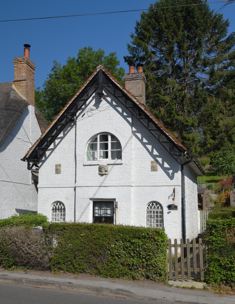
Cottage, early C19, painted brick with plain tile roof, hipped to rear and ridge stack. One and a half storeys, picturesque estate cottage with ornamented gable end to road. Pierced bargeboards and pendant, stone band. Centre projects with first floor broad arched-headed triple casement and reused carved medieval corbel below. Centre door flanked by small arched-headed windows with leaded iron casements and intersecting-tracery heads. Reused C17 grotesque carvings over. Rubble stone side walls. One of the series of estate cottages of Erlestoke Park elaborated with miscellaneous carved fragments.
Listing NGR: ST9626953894
External links are from the relevant listing authority and, where applicable, Wikidata. Wikidata IDs may be related buildings as well as this specific building. If you want to add or update a link, you will need to do so by editing the Wikidata entry.


Other nearby listed buildings