Latitude: 51.2835 / 51°17'0"N
Longitude: -2.0551 / 2°3'18"W
OS Eastings: 396251
OS Northings: 153821
OS Grid: ST962538
Mapcode National: GBR 2VQ.H70
Mapcode Global: VHB4M.BZDY
Plus Code: 9C3V7WMV+CW
Entry Name: Barton Cottage Pollards
Listing Date: 19 March 1962
Last Amended: 3 April 1987
Grade: II
Source: Historic England
Source ID: 1183542
English Heritage Legacy ID: 311247
ID on this website: 101183542
Location: Erlestoke, Wiltshire, SN10
County: Wiltshire
Civil Parish: Erlestoke
Traditional County: Wiltshire
Lieutenancy Area (Ceremonial County): Wiltshire
Church of England Parish: Erlestoke Holy Saviour
Church of England Diocese: Salisbury
Tagged with: Cottage
ST 96 53 ERLESTOKE HIGH STREET (south side)
15/97 Nos 51 and 53 (Barton Cottage and Pollards) (formerly listed as 19.3.62 The Old Vicarage)
II
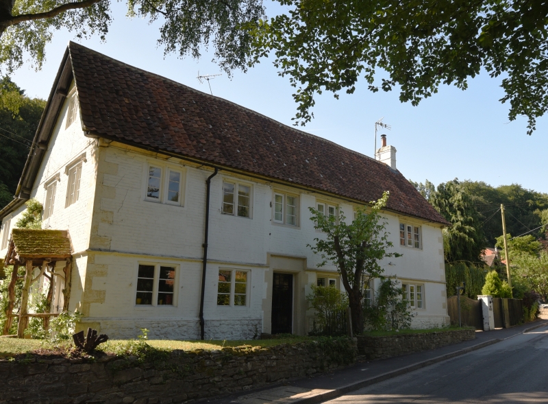
House, now two, late C17, extended, painted brick Flemish bond, with ashlar dressings and pantiled roof. West end stack. Original house has formal 2-storey, 5-window front of 2-light ovolo-moulded recessed mullion windows, central 6-panel door, rubble stone plinth, dripcourse, stepped over door and coved eaves cornice. Flush quoins. West end one-window matching addition with 3-light similar mullion window each floor. East end has attic 2-light with dripstone, 2 first floor 2-lights with hoodmoulds and dripcourse over half-glazed door and 2-light. A rear wing beyond is mostly C20 but one original ground floor 2-light.
Listing NGR: ST9625153821
External links are from the relevant listing authority and, where applicable, Wikidata. Wikidata IDs may be related buildings as well as this specific building. If you want to add or update a link, you will need to do so by editing the Wikidata entry.


Other nearby listed buildings