Latitude: 51.2352 / 51°14'6"N
Longitude: 0.6709 / 0°40'15"E
OS Eastings: 586554
OS Northings: 151832
OS Grid: TQ865518
Mapcode National: GBR QT4.GFS
Mapcode Global: VHJMP.L61Y
Plus Code: 9F326MPC+39
Entry Name: Mill House
Listing Date: 14 December 1984
Grade: II
Source: Historic England
Source ID: 1299686
English Heritage Legacy ID: 173778
ID on this website: 101299686
Location: Harrietsham, Maidstone, Kent, ME17
County: Kent
District: Maidstone
Civil Parish: Harrietsham
Traditional County: Kent
Lieutenancy Area (Ceremonial County): Kent
Tagged with: House
HARRIETSHAM FAIRBOURNE LANE TQ 85 SE (west side)
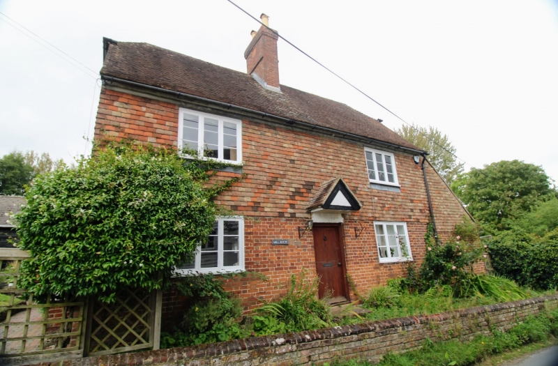
4/45 Mill House GV II House. 1766, altered in C19. Ground floor red brick with occasional grey headers in Flemish bond, first floor tile-hung, plain tile roof. Lobby entry. 2 storeys and brick ridge stack. Regular fenestration of 2 three-light casements. Central panelled door. Hood over door in form of small solid projecting triangular pediment over door, with flat soffit and plain tile roof. Lean-to to right with integral brick-work. Date on stack A B . Interior not inspected. 1766
Listing NGR: TQ8655451832
External links are from the relevant listing authority and, where applicable, Wikidata. Wikidata IDs may be related buildings as well as this specific building. If you want to add or update a link, you will need to do so by editing the Wikidata entry.


Other nearby listed buildings