Latitude: 51.2387 / 51°14'19"N
Longitude: 0.6691 / 0°40'8"E
OS Eastings: 586417
OS Northings: 152216
OS Grid: TQ864522
Mapcode National: GBR QT4.80G
Mapcode Global: VHJMP.K438
Plus Code: 9F326MQ9+FM
Entry Name: Ramchild
Listing Date: 14 December 1984
Grade: II
Source: Historic England
Source ID: 1086152
English Heritage Legacy ID: 173775
ID on this website: 101086152
Location: Harrietsham, Maidstone, Kent, ME17
County: Kent
District: Maidstone
Civil Parish: Harrietsham
Built-Up Area: Harrietsham
Traditional County: Kent
Lieutenancy Area (Ceremonial County): Kent
Tagged with: Building
HARRIETSHAM FAIRBOURNE LANE TQ 85 SE (east side)
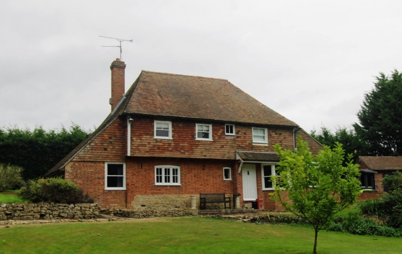
4/42 Ramchild II House. Late C16 or early C17 and late C19. Timber framed. Ground floor red brick in Flemish bond, first floor tile-hung. Plain tile roof. 2 storeys on high stone plinth with continuous jetty. Hipped roof. Red brick stack at left end, and projecting to right end. Irregular fenestration of late C19 windows; 3 sashes and one small casement. Jetty underbuilt at right end in late C19 in red brick with plain-tiled bracketted pentice over, canted bay to right end and ribbed door in left end up 3 steps. Late C19 lean-to to left with plain tile roof. Interior not inspected.
Listing NGR: TQ8641752216
External links are from the relevant listing authority and, where applicable, Wikidata. Wikidata IDs may be related buildings as well as this specific building. If you want to add or update a link, you will need to do so by editing the Wikidata entry.


Other nearby listed buildings