Latitude: 52.1083 / 52°6'29"N
Longitude: -1.6218 / 1°37'18"W
OS Eastings: 425995
OS Northings: 245617
OS Grid: SP259456
Mapcode National: GBR 5P6.YJV
Mapcode Global: VHBYF.T8YM
Plus Code: 9C4W495H+87
Entry Name: Restways
Listing Date: 13 October 1966
Grade: II
Source: Historic England
Source ID: 1299525
English Heritage Legacy ID: 305873
ID on this website: 101299525
Location: Halford, Stratford-on-Avon, Warwickshire, CV36
County: Warwickshire
District: Stratford-on-Avon
Civil Parish: Halford
Built-Up Area: Halford
Traditional County: Warwickshire
Lieutenancy Area (Ceremonial County): Warwickshire
Church of England Parish: Halford
Church of England Diocese: Coventry
Tagged with: Building
HALFORD QUEEN'S STREET SP2545, SP2645 (West side) 6/110, 7/110 Restways 13/10/66
GV II
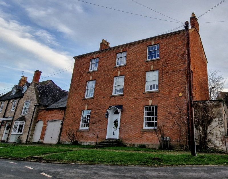
House. Late C18. Red brick laid to Flemish bond. Slate roof. Brick end stacks. 3 storeys. 3-window range. Central entrance. 3 semi-circular stone steps. Doorway with open pedimented fluted doorcase, panelled reveals, 6-panelled door and fanlight. Entrance is flanked by 16-pane sashes with keyblocks and rubbed brick heads. First floor has 2 similar windows and a blocked fake window. 3 similar smaller windows to second floor. All windows have stone sills and glazing bars. Moulded and chamfered stone eaves cornice. Interior not inspected.
Listing NGR: SP2599545617
External links are from the relevant listing authority and, where applicable, Wikidata. Wikidata IDs may be related buildings as well as this specific building. If you want to add or update a link, you will need to do so by editing the Wikidata entry.


Other nearby listed buildings