Latitude: 52.6849 / 52°41'5"N
Longitude: -1.8323 / 1°49'56"W
OS Eastings: 411434
OS Northings: 309700
OS Grid: SK114097
Mapcode National: GBR 3C9.RL0
Mapcode Global: WHCGN.TSN2
Plus Code: 9C4WM5M9+X3
Entry Name: 2, 3 and 4, the Close
Listing Date: 5 February 1952
Grade: II
Source: Historic England
Source ID: 1298426
English Heritage Legacy ID: 382762
ID on this website: 101298426
Location: Lichfield, Staffordshire, WS13
County: Staffordshire
District: Lichfield
Civil Parish: Lichfield
Built-Up Area: Lichfield
Traditional County: Staffordshire
Lieutenancy Area (Ceremonial County): Staffordshire
Tagged with: Building
LICHFIELD
SK1109NW THE CLOSE 1094-1/4/194 (West side) 05/02/52 Nos.2, 3 AND 4
GV II
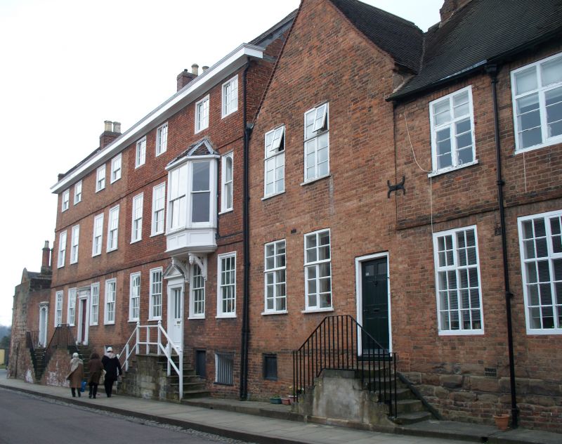
Two houses, one converted into two. c1720. Brick; double-span tile roof with brick stacks. Double-depth plan. Georgian style. 3 storeys and basement; 8-window range forming 2 symmetrical compositions. Brick platt bands and timber top cornice. 2 entrances up opposed steps with plain iron handrails, that to No.3 has doorcase with architrave, frieze and consoled cornice, and 6-fielded-panel door; that to No.4 has doorcase with eared architrave, frieze and pediment, half-glazed door. Varied basement openings; windows have rubbed brick flat arches and 12-pane sashes with moulded frames, No.3 has two 4-pane sashes and two 6-pane sashes to 2nd floor; No.4 has large C19 canted oriel with hipped roof and plate glass sashes to 1st floor right, and horizontally sliding sashes to 2nd floor. Left return has C18 rainwater head with downspout; single-storey wing, front wall to street with segmental-headed entrance to No.2 up steps with plain iron handrail, doorcase with pilasters and bracketed cornice, 6-panel door. Rear elevation has varied fenestration including one ground floor cross-casement; entrance with 2-panel door in pegged frame and C19 trellis porch. Built on the site of medieval buildings of the south court of the Vicars' Close which were destroyed during the Civil War. (Victoria History of the County of Stafford: Greenslade M W: Lichfield: Oxford: 1990-: P.59; Drury P: The Capitular Estate of Dean and Chapter of Lichfield Cathedral: 1987-).
Listing NGR: SK1142509697
External links are from the relevant listing authority and, where applicable, Wikidata. Wikidata IDs may be related buildings as well as this specific building. If you want to add or update a link, you will need to do so by editing the Wikidata entry.


Other nearby listed buildings