Latitude: 54.0493 / 54°2'57"N
Longitude: -2.804 / 2°48'14"W
OS Eastings: 347457
OS Northings: 461776
OS Grid: SD474617
Mapcode National: GBR 8PVM.R6
Mapcode Global: WH846.WHY3
Plus Code: 9C6V25XW+PC
Entry Name: 23, Castle Hill
Listing Date: 18 February 1970
Last Amended: 13 March 1995
Grade: II
Source: Historic England
Source ID: 1298386
English Heritage Legacy ID: 383072
ID on this website: 101298386
Location: Lancaster, Lancashire, LA1
County: Lancashire
District: Lancaster
Electoral Ward/Division: Castle
Parish: Non Civil Parish
Built-Up Area: Lancaster
Traditional County: Lancashire
Lieutenancy Area (Ceremonial County): Lancashire
Church of England Parish: Lancaster St Mary with St John and St Anne
Church of England Diocese: Blackburn
Tagged with: House Restaurant Building Studio
LANCASTER
SD4761NW CASTLE HILL 1685-1/6/39 (East side) 18/02/70 No.23 (Formerly Listed as: CASTLE HILL (South East side) No.23 Portofino Restaurant)
GV II
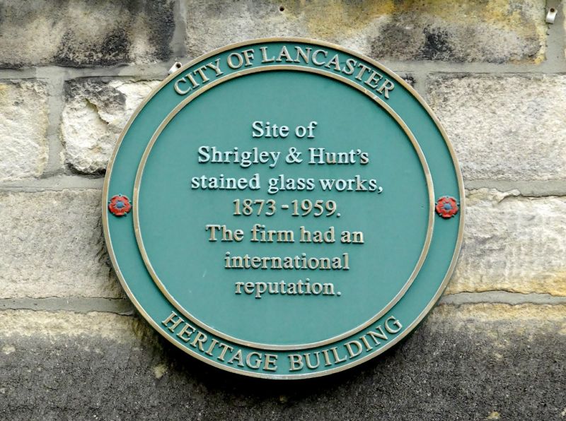
House, subsequently a stained glass studio and workshop, now a restaurant. Later C18 (before 1778), altered in late C19. Sandstone ashlar facade with coursed rubble to the side and rear. Slate roof, with the remains of a coped gable on the right and gable chimneys, that on the right being on the roof slope. Double-depth plan with a rear wing to right. 3 storeys above a cellar, and 3 bays with a very prominent added attic. Chamfered quoins. Ground floor has a waggon entrance with 2 panelled doors on the left, and then the remains of a ground-floor sill band interrupted by 2 large late C19 rectangular windows with decorated wooden architraves and stained-glass panels in geometrical leading, but with plain glass in the lower part of the left-hand window. The upper floors have 12-pane sashes within plain raised surrounds, and the heads of the top windows, which are shorter, are incorporated in a plain frieze which has the remains of painted lettering, reading 'STAINED GLASS HERALDIC...'. The attic storey has a continuous studio window of 6 casement lights with a boarded gablet over each pair; each light is divided into 6 large panes of square-leaded glazing; there is similar glazing in the returned ends. The long rear wing has in its gable large doorways, presumably, once windows, on the first and second floors leading to a steel fire escape; on the north side it has a glazed timber-framed projection. HISTORY: formerly the premises of Messrs Shrigley and Hunt, stained glass makers. The firm developed from Shrigley and Son, founded in the late C18, which became Shrigley and Hunt in 1870. It moved to premises in West Road before closing in the 1970s. (Lancaster City Museums Local Studies: Price, J: Industrial Lancaster: Lancaster: 1989-).
Listing NGR: SD4745761776
External links are from the relevant listing authority and, where applicable, Wikidata. Wikidata IDs may be related buildings as well as this specific building. If you want to add or update a link, you will need to do so by editing the Wikidata entry.


Other nearby listed buildings