Latitude: 54.049 / 54°2'56"N
Longitude: -2.8039 / 2°48'14"W
OS Eastings: 347462
OS Northings: 461742
OS Grid: SD474617
Mapcode National: GBR 8PVM.R9
Mapcode Global: WH846.WHZC
Plus Code: 9C6V25XW+HC
Entry Name: 29, Castle Hill
Listing Date: 18 February 1970
Grade: II
Source: Historic England
Source ID: 1194939
English Heritage Legacy ID: 383074
ID on this website: 101194939
Location: Lancaster, Lancashire, LA1
County: Lancashire
District: Lancaster
Electoral Ward/Division: Castle
Parish: Non Civil Parish
Built-Up Area: Lancaster
Traditional County: Lancashire
Lieutenancy Area (Ceremonial County): Lancashire
Church of England Parish: Lancaster St Mary with St John and St Anne
Church of England Diocese: Blackburn
Tagged with: Building Warehouse Pub Shop Office building
LANCASTER
SD4761NW CASTLE HILL 1685-1/6/41 (East side) 18/02/70 No.29
GV II
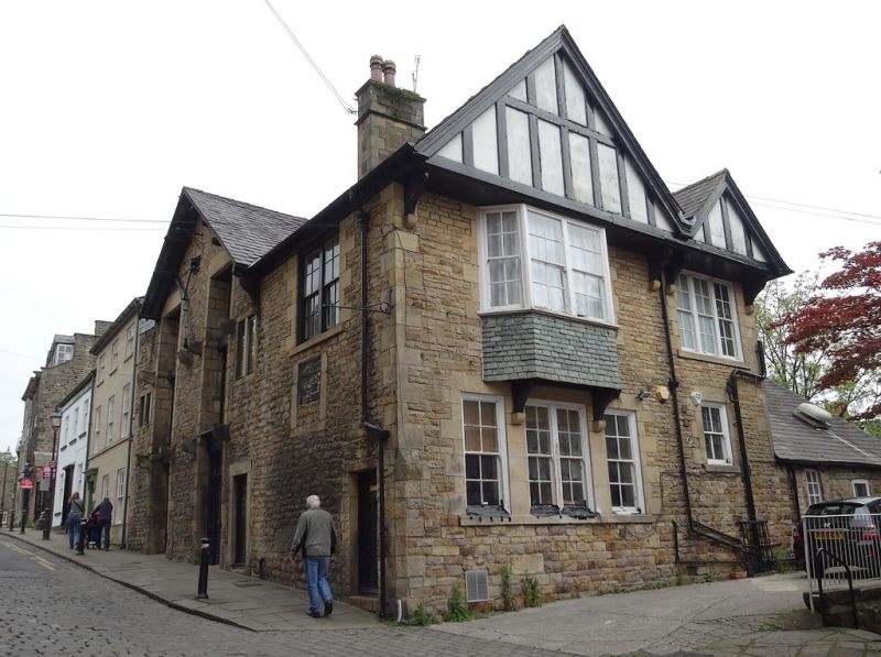
Warehouse, now shop and public house. Mid C18, altered and extended late C19. Roughly coursed sandstone rubble with ashlar dressings. Slate roofs. Tall chimney stacks above the right-hand and left-hand side walls of the range on the left, which has its gable to the road. This now has 3 storeys, but the roof, which has strongly projecting but asymmetrical verges, has obviously been lowered. The facade is symmetrical with 2 loading slots with projecting corbels on the first and second floors; between the slots is a late C19 steel crane, and to either side on the first floor is a roughly square window with plain jambs, that to the left still has a square mullion. On the ground floor the loading slots are glazed as shop windows, to right a doorway with a plain surround. Beyond this, on the right, is a 2-storey extension, enlarged or remodelled in the late C19 under 2 roofs whose ridges run parallel to the street and terminate in 2 timber-framed projecting gables. Below the larger (left-hand) gable is a canted oriel with a tile-hung apron above a tripartite ground-floor window. In the gable are painted traces of the name 'RICHARD HINDE'. To the right below the smaller gable a tripartite sash above a small plain sash. Beyond is a further extension under a cat-slide roof, which is carried down from the rear of the main warehouse range. INTERIOR: very large barrel-vaulted cellars under the main range. HISTORY: Richard Hinde was a wine and spirit merchant, mentioned in directories of 1851 and 1913.
Listing NGR: SD4746561743
External links are from the relevant listing authority and, where applicable, Wikidata. Wikidata IDs may be related buildings as well as this specific building. If you want to add or update a link, you will need to do so by editing the Wikidata entry.


Other nearby listed buildings