Latitude: 52.7516 / 52°45'5"N
Longitude: 0.3946 / 0°23'40"E
OS Eastings: 561710
OS Northings: 319795
OS Grid: TF617197
Mapcode National: GBR N3Q.JL2
Mapcode Global: WHJP7.135D
Plus Code: 9F42Q92V+JR
Entry Name: St Margaret's Vicarage
Listing Date: 1 December 1951
Grade: II
Source: Historic England
Source ID: 1298152
English Heritage Legacy ID: 384297
ID on this website: 101298152
Location: King's Lynn, King's Lynn and West Norfolk, Norfolk, PE30
County: Norfolk
District: King's Lynn and West Norfolk
Electoral Ward/Division: St Margarets with St Nicholas
Parish: Non Civil Parish
Built-Up Area: King's Lynn
Traditional County: Norfolk
Lieutenancy Area (Ceremonial County): Norfolk
Tagged with: Clergy house
KING'S LYNN
TF6119NE ST MARGARET'S PLACE 610-1/9/245 (West side) 01/12/51 St Margaret's Vicarage
GV II
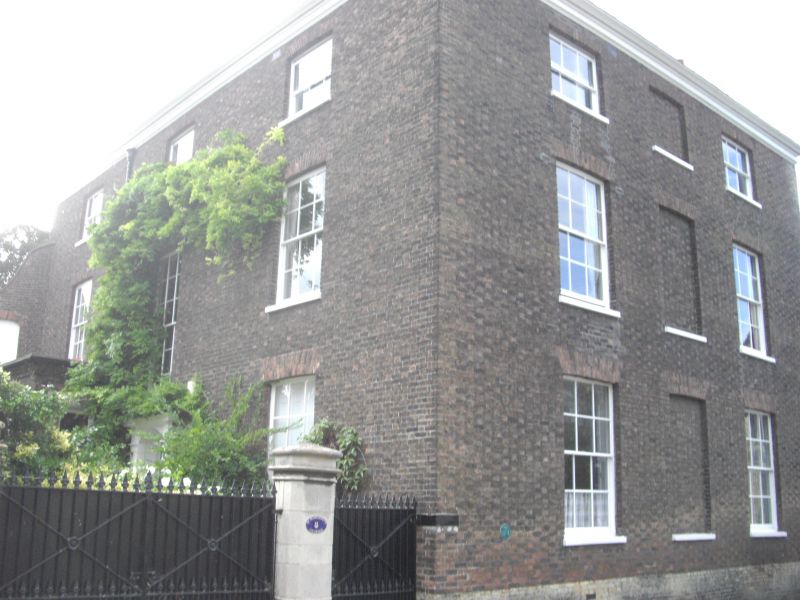
House. Said to be 1830, but looks c1810, became vicarage 1912. Brown brick with slate roof. 3 storeys. Street front in 3 bays, no doorway. Centre bays blind to each floor. Sashes with glazing bars and gauged skewback arches. Wide 3-bay entrance front to south entered through a central panelled door set within a simple timber case with deep panelled reveals with reeding. To left of door is a mid C19 single-storey bay. Fenestration of sashes with glazing bars and gauged skewback arches, that over the door taller to light staircase hall within. At west end of this front is a full-height screen wall with a swept top and a blocked window at the first floor level. This was part of a demolished 2-storey structure attached to the west wall of the house (still shown on 1965 ed. O.S. map). Hipped roof to main block above timber eaves cornice and two brick stacks. Running west from centre of house is an early C16 brick wall with a 4-centred arch towards the west end, through which is a rectangular compound formerly part of the ground floor of a brick C16 building. INTERIOR. Staircase with 2 stick balusters to each tread and a wreathed handrail. Open string. Panelled internal doors remain and sections of unremarkable plaster cornices. The house was built on the site of a C17 house where the Burney family lived, from 1753-1760.
Listing NGR: TF6171019794
External links are from the relevant listing authority and, where applicable, Wikidata. Wikidata IDs may be related buildings as well as this specific building. If you want to add or update a link, you will need to do so by editing the Wikidata entry.


Other nearby listed buildings