Latitude: 54.1805 / 54°10'49"N
Longitude: -0.3229 / 0°19'22"W
OS Eastings: 509551
OS Northings: 477382
OS Grid: TA095773
Mapcode National: GBR VN53.W4
Mapcode Global: WHHDS.05HZ
Plus Code: 9C6X5MJG+6R
Entry Name: Denmark House
Listing Date: 23 August 1985
Grade: II
Source: Historic England
Source ID: 1296632
English Heritage Legacy ID: 326986
ID on this website: 101296632
Location: Hunmanby, North Yorkshire, YO14
County: North Yorkshire
District: Scarborough
Civil Parish: Hunmanby
Built-Up Area: Hunmanby
Traditional County: Yorkshire
Lieutenancy Area (Ceremonial County): North Yorkshire
Church of England Parish: Hunmanby All Saints
Church of England Diocese: York
Tagged with: House
TA 09 77
12/49
HUNMANBY
CROSS HILL
(west side)
No. 21 (Denmark house)
GV
II
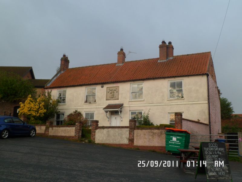
House. Mid-late C18, with later alteration. Colour-washed, rendered brick
to front; colour-washed brick gable wall to left; whitewashed chalk to rear;
pantile roof; brick stacks. Central staircase plan, one room deep, wits
service outshut to rear right. 2-storey, symmetrical 4-window front.
Centre 4-panel door with divided overlight, under tile and timber pent
porch. Two 4-pane sashes with timber sills on either side. 4 similar
windows to first floor. At first floor centre is a C20 square, recessed
panel containing a raised relief of a buck's head. Raised first floor band.
Stepped brick eaves course. One end stack, one left and one right of
centre. Rear; round-headed, radial-glazed staircase window.
Listing NGR: TA0955177382
External links are from the relevant listing authority and, where applicable, Wikidata. Wikidata IDs may be related buildings as well as this specific building. If you want to add or update a link, you will need to do so by editing the Wikidata entry.


Other nearby listed buildings