Latitude: 54.1805 / 54°10'49"N
Longitude: -0.3217 / 0°19'18"W
OS Eastings: 509632
OS Northings: 477384
OS Grid: TA096773
Mapcode National: GBR VN63.44
Mapcode Global: WHHDS.153Z
Plus Code: 9C6X5MJH+68
Entry Name: Mill Farmhouse
Listing Date: 23 August 1985
Grade: II
Source: Historic England
Source ID: 1167941
English Heritage Legacy ID: 326978
ID on this website: 101167941
Location: Hunmanby, North Yorkshire, YO14
County: North Yorkshire
District: Scarborough
Civil Parish: Hunmanby
Built-Up Area: Hunmanby
Traditional County: Yorkshire
Lieutenancy Area (Ceremonial County): North Yorkshire
Church of England Parish: Hunmanby All Saints
Church of England Diocese: York
Tagged with: Farmhouse
TA 09 77
12/41
HUNMANBY
BRIDLINGTON STREET
(north-east side)
No. 7 (Mill Farmhouse)
GV
II
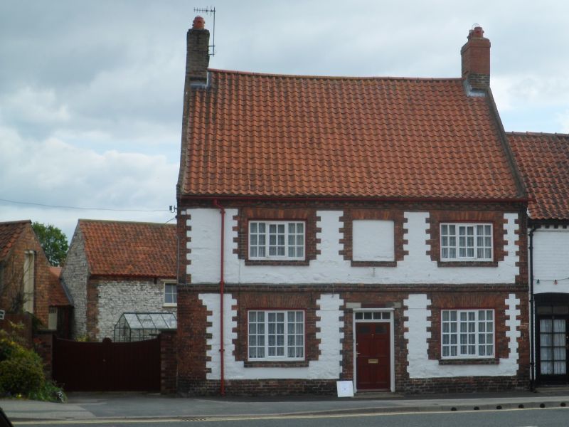
Farmhouse. Mid-late C18. Coursed, squared chalk (now white-washed) on
brick plinth; brick gable ends; red brick dressings; pantile roof; brick
stacks. Central stairhall plan, 2 rooms deep. 2-storey, symmetrical 2-
window front. Brick quoins. Central panelled door with overlight, flanked
by C20 3-light horizontal sliding sashes with glazing bars. Two similar
windows to first floor, with blocked window opening at centre. All openings
are set in brick quoined surrounds, the windows with cambered arches of
guaged brick. Raised brick first floor band. Double dentilled brick eaves
course. End stacks to steeply pitched roof. Tumbled brick gables.
Reference: B. Harrison and B. Mutton, Vernacular Houses in North Yorkshire
and Cleveland, Fig. 7. 41.
Listing NGR: TA0963277384
External links are from the relevant listing authority and, where applicable, Wikidata. Wikidata IDs may be related buildings as well as this specific building. If you want to add or update a link, you will need to do so by editing the Wikidata entry.


Other nearby listed buildings