Latitude: 51.4016 / 51°24'5"N
Longitude: -1.3242 / 1°19'27"W
OS Eastings: 447105
OS Northings: 167167
OS Grid: SU471671
Mapcode National: GBR 81Z.21H
Mapcode Global: VHCZK.019C
Plus Code: 9C3WCM2G+J8
Entry Name: Bridge over River Kennet
Listing Date: 29 September 1950
Grade: II*
Source: Historic England
Source ID: 1290920
English Heritage Legacy ID: 394290
Also known as: Town Bridge
Kennet Bridge
Bridge Street
ID on this website: 101290920
Location: Newbury, West Berkshire, RG14
County: West Berkshire
Civil Parish: Newbury
Built-Up Area: Newbury
Traditional County: Berkshire
Lieutenancy Area (Ceremonial County): Berkshire
Church of England Parish: Newbury St Nicolas
Church of England Diocese: Oxford
Tagged with: Road bridge
1. BRIDGE STREET 5127 Bridge over River Kennet sU 4767 SW 6/47 29.9.50
II*
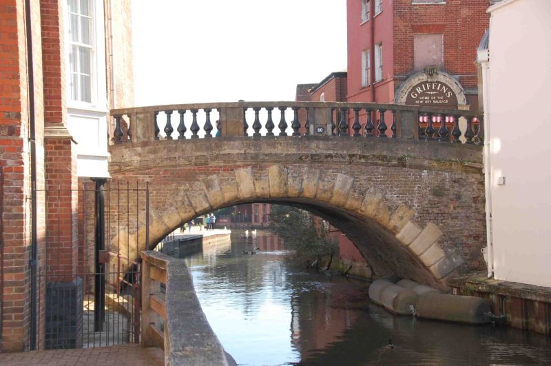
2. 1769-72 by James Clarke replacing an earlier wooden bridge of 1726. Brick with stone ashlar dressings, Three span structure of which the 2 outer spans are now concealed by approach roads on either side. Central segmental-arched span with rusticated block voussoirs and 4 bay balustrade with cast-iron balusters. On each side at the north and south ends are the remains of recesses which probably formed shelters. Pilasters with moulded caps support semi-circular arches with scroll- keystones, all in stone. Three of the arches have been incorporated in the adjoining shops while the plinth forms a doorway to No 1 Bridge Street. (Newbury Buildings Past and Present (1973) 16).
Listing NGR: SU4710567167
External links are from the relevant listing authority and, where applicable, Wikidata. Wikidata IDs may be related buildings as well as this specific building. If you want to add or update a link, you will need to do so by editing the Wikidata entry.


Other nearby listed buildings